Why Tucson Hikes? I have written two separate blogs about our adventures in Tucson which both included some basic hiking information. Visiting Tucson Part I and Visiting Tucson Part II. However, I do not feel that I did justice to the incredible amount and variety of hiking in this concentrated area. We were so excited to hike in Saguaro East and West National Park, I hadn’t realized the enormous amount of trails we would find within an hour of our home base near Saguaro East NP.
As our journey has progressed we have become better at finding the information we are searching for. That sounds like an obvious statement. Ask a question and get an answer, however what we have found is we often do not know the right questions to ask. One of the new tricks we have learned is how to use our Alltrails app in a different way. We use the app to determine trail lengths, elevation gains, and trail head location.
Using Alltrails in a Unique Way
What we discovered a few months ago is how much trail information I was overlooking. I was frustrated reading the comments posted about a particular trail. They were so varied, it was like the people had not even hiked the same trail. It was then when I realized I could view the histories of the individuals commenting. This gave me the ability to determine what type of a hiker they were by reading about other trails they had hiked. I also found additional local trail information there.
Using this new found bounty of information we began finding the trails that locals hiked, away from the crowds and into the backcountry. It also helped us determine which reviews applied to our abilities and fitness level. Now, when we arrive in a new area, I am better equipped to find trails we will be interested in hiking. As I was researching some of the routes in Saguaro NP, which I knew we would be hiking, I also read about Sabino Canyon, Madera Canyon and the Pusch Ridge Wilderness including Mt. Lemmon.
This piece will focus on these areas and the uniqueness of each. In our short stay in Tucson we barely had enough time for a couple of hikes in each area. This list is some of our favorites.
Madera Canyon
Madera Canyon is a diverse hiking area in the Santa Rita Mountains, located in the Coronado National Forest. A National Park Pass is accepted for use of the day use areas and parking lots. If you do not have one, you can pay a daily fee. When we first arrived in Tucson, we noticed a prominent mountain range to our south covered in snow. It peaked our interest!
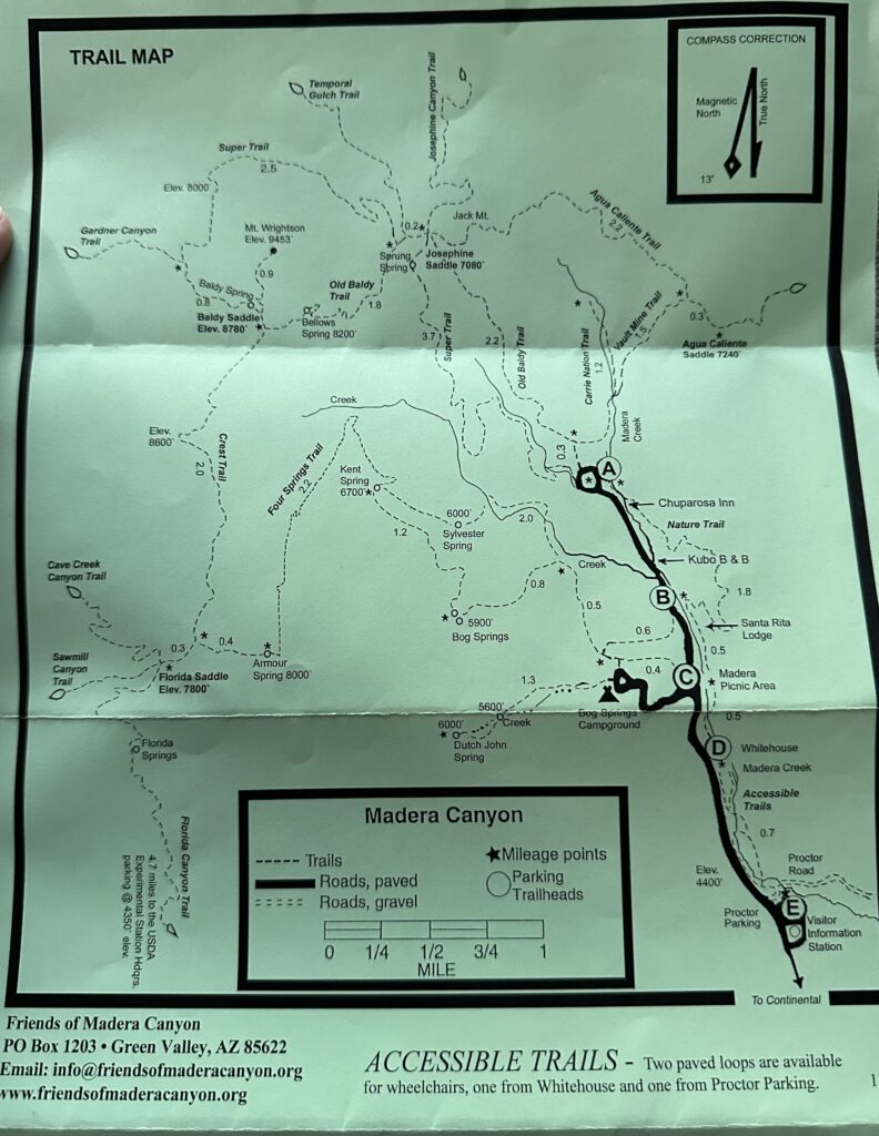
Madera Canyon’s elevation is about 4900′ which allows relief from Tucson’s higher summer temperatures, and provides access to miles of trails, picnic areas, and campgrounds. Dogs are allowed which made Teddy happy. There is also an ADA accessible nature trail which follows part of Madera Creek. Grasslands, juniper and oak woodlands allow for a vast diversity of animals and birds. I had difficulty finding trail maps on-line but were excited to find the above map when we arrived at the Old Baldy Trailhead.
Mt. Wrightson
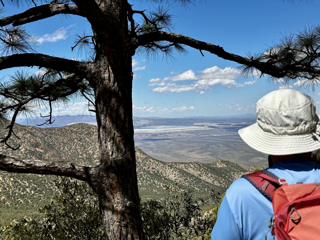
Mt. Wrightson at 9453′ of elevation is the highest peak and unlike many of these Southwestern peaks it is a non-technical climb, which means reasonably fit hikers can climb it. It is 10.6 miles round trip, using the Baldy trail, with 3969′ of elevation gain round trip. This peak immediately intrigued us. It is rare that we find an elevation gain of 4000′ in the hiking trails where we have visited. It reminds us of home and hiking Mt. Washington which has very similar gains and milages. As the peak and trail leading to the peak was covered with over a foot of snow above the saddle, we decided it was best at this time to complete an alternate loop.
We highly recommend the Old Baldy trail to Josephine Saddle (elevation 7000′), which we made into a loop by descending the Super trail. This loop is just over six miles and about 1700′ of elevation gain. Unfortunately we ran out of time in Tucson before we were able to complete more hikes in Madera Canyon. We hope to spend more time in the future enjoying this beautiful area, as well as climbing Mt. Wrightson!
Sabino Canyon Recreation Area
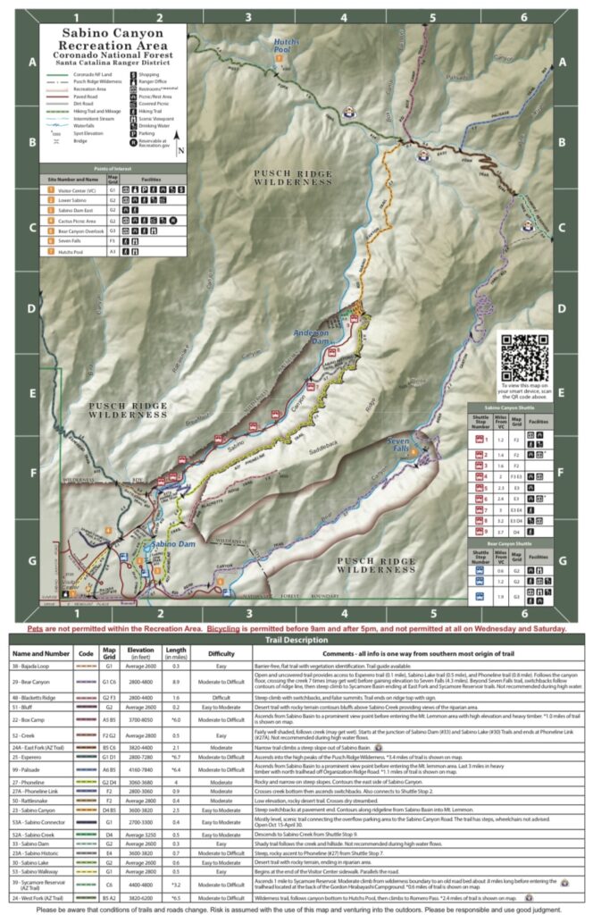
Sabino Canyon Recreation Area is another incredible hiking area with varied terrain. We hiked several trails in the canyon and enjoyed all of them. Sabino Canyon is a busy place everyday of the week and the parking area fills up fast, especially on weekends. There is a fee for parking, however a National Park Pass is accepted. Dogs are not allowed.
In addition to paved paths and many trails with gentle grades, Sabino Canyon is also serviced by a trolley allowing access to the top of the creek by trolly. Thus providing anyone the ability to be immersed in the amazing geology, plants, and wildlife of the canyon. A ticket is required to ride the trolly, with nine hop on and hop off locations, which allows you to explore at your own pace and create your own experience.
Phoneline Trail
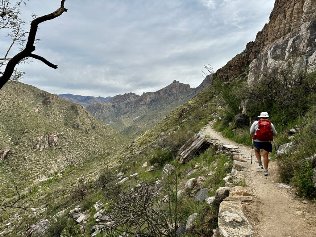
The phone line trail is a gradual hike with good footing. The sometimes narrow trail weaves its way towards the top of the canyon staying high on the ridge, allowing for great canyon views. From the visitor center to the end of the canyon hike it is about five miles with 1400′ of elevation gain.
Once we arrived at the top of the canyon we decided to check with the first trolley we saw to ask if there was availability for us to purchase a ride back down the canyon. If there is room hikers are allowed to purchase an eight dollar pass from the trolley operator to ride back to the visitor center. It was a simple and great choice. The road down the canyon twists and turns following the path of the creek crossing it many times. It was a fun ride in the open air trolley.
Many people choose to ride the trolley to the top of the canyon and then hike back to the visitor center. We always prefer to hike up. Whatever you choose, I think you will be happy with the views.
Seven Falls
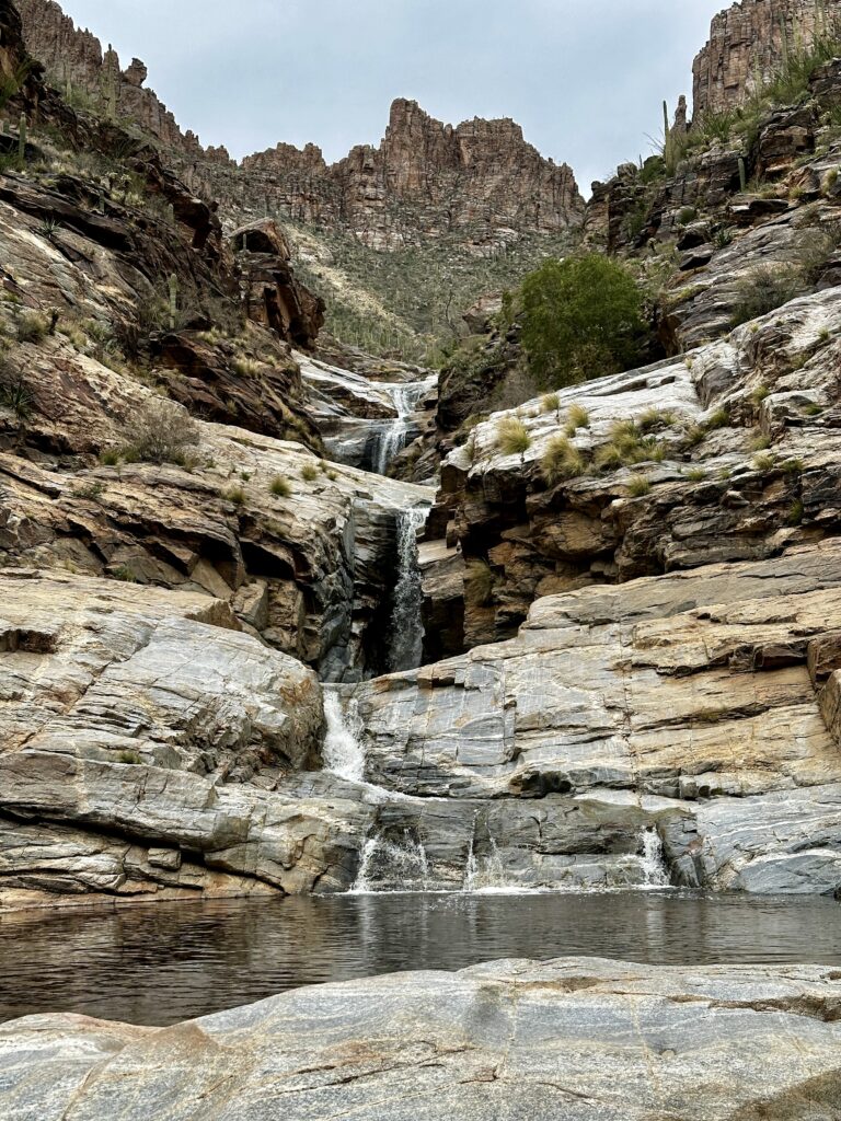
Our favorite hike, which we hiked twice, was to Seven Falls through Bear Canyon. This heavily used trail leads just over four miles through amazing cacti filled terrain. The rugged steep sided Canyon walls provide an incredible background to the desert fauna. We completed our hikes in the spring and we greeted with many crossings of the creek. The trail is gradual with good footing. Hiking amongst all the other people is not my favorite, I prefer the trails in the middle of no where. However, the enormous waterfalls at the end of this hike made the crowded trail worthwhile. If you wish to see a glimpse of our hike watch our video of the week https://hikingmemere.com/video-of-the-week-7-falls/.
There are short hikes through desert botanical gardens and hikes which allow easy access to the creeks. We saw many kids playing in the cool creek water. This recreation area is close to downtown Tucson and it is a wonderful place for families.
Pusch Ridge Wilderness
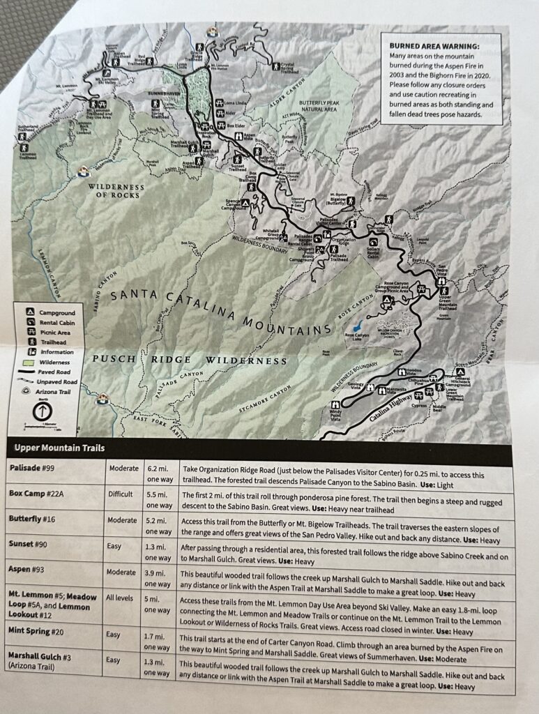
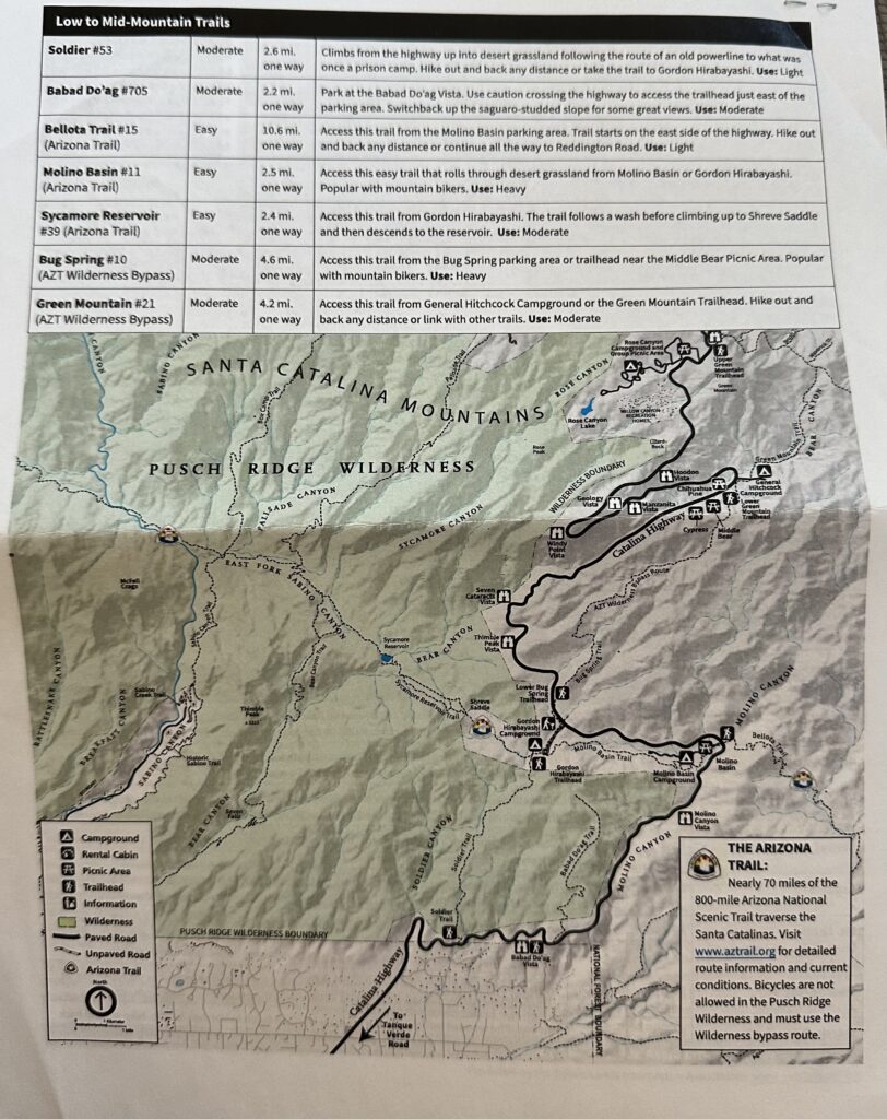
The Pusch Ridge Wilderness was a bit confusing to us at first. The wilderness area surrounds Sabino Canyon Recreation Area and can be accessed from there. Most of the trails are also easily accessible from Catalina Highway. Catalina Highway leads twenty-four miles from Tanque Verde road in the valley to the top of Mt. Lemmon an elevation gain of about 6000′. The road is opened year round except when snow is being cleared. For a view of the mountain drive watch the video of our drive along the scenic byway.
Mt. Lemmon is the highest peak in the Santa Catalina Mountains, which are a sky island. Sky islands are isolated mountains which are surrounded by very different lowlands. There are five different habitats which you will encounter on a drive to Mt. Lemmon. Each of these habitats provide a different type of hiking experience.
Mt. Lemmon
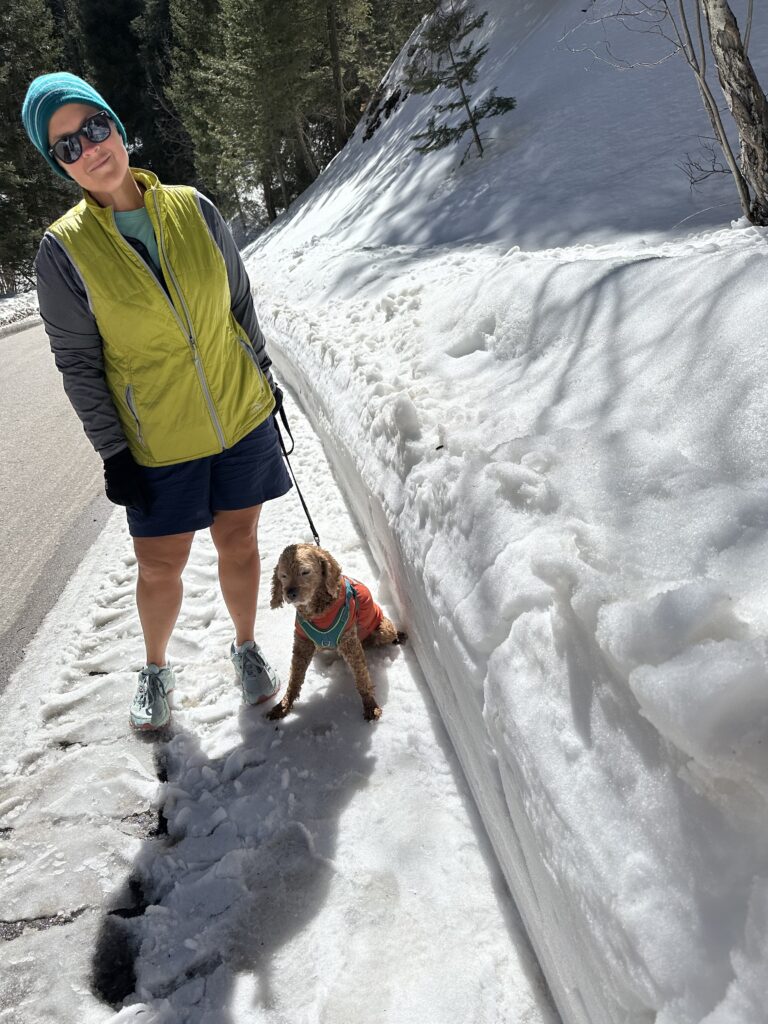
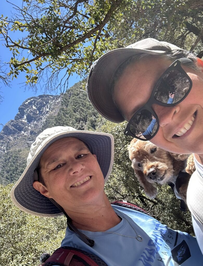
This hike to the observatory at the top of Mt. Lemmon began in the parking lot of the Mt. Lemmon ski area. There is a gate which is closed throughout the winter. We simply hiked the road which we were happy was plowed. It was a couple mile hike with an additional 500′ of elevation gain. We topped out at about 9125′. Teddy was excited to hike with us. Dogs are allowed in the wilderness area.
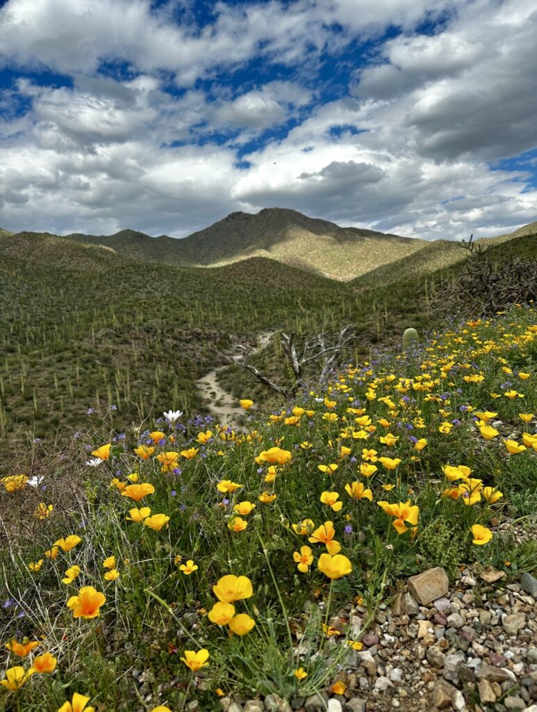
Babad Do’ag Trail
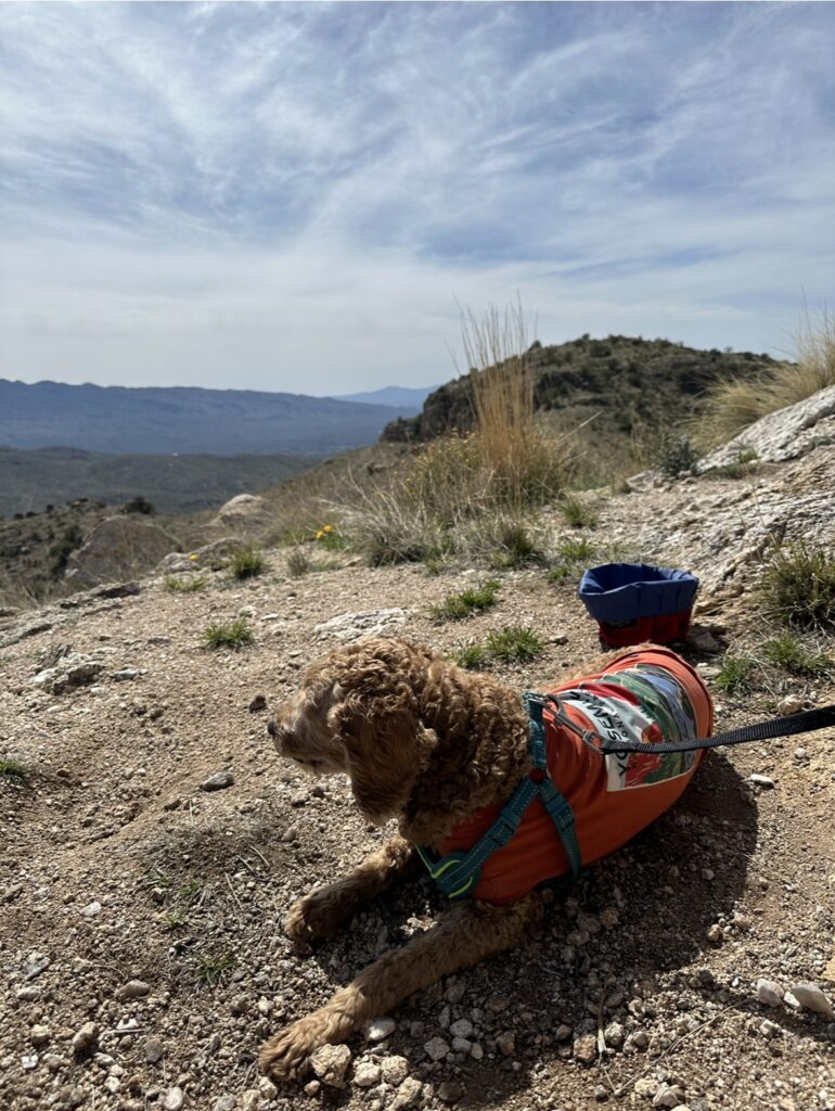
Babad Do’ag trail is a wonderful trail which begins just a few miles up the Catalina highway. Parking is at the Babad Do’ag vista. After a short walk along the road a trail sign appears on the left. The trail is an out and back and round trip is just under five miles with 1200′ of elevation gain.
The poppies were blooming and the ridges glowed with color. Most of the trail had moderate grades and was easy to follow. We saw a couple of hikers throughout our hike but were surprised to have this beautiful trail mostly to ourselves. Teddy even approved!
The Santa Catalina Mountains and Pusch Ridge Wilderness provide opportunity for countless hikes. The Arizona Trail also prominently crosses through this area. There were several thru hikers, and we had the opportunity to give one couple a ride into to Tucson, for a re-stocking trip. We met them at a trailhead and after talking for a bit we found out they wanted to head into town, where we were already headed. We had great conversation on our drive down the mountain and learned a lot about the Arizona Trail and Sky Islands. Maybe someday!
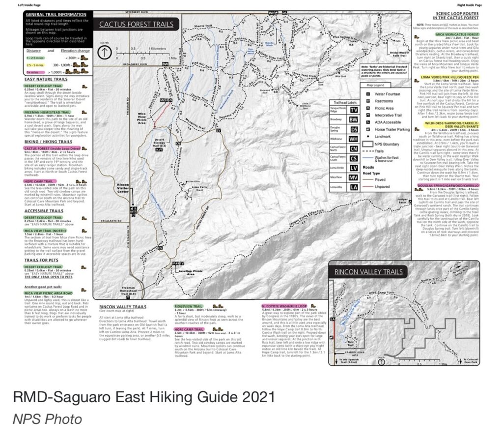
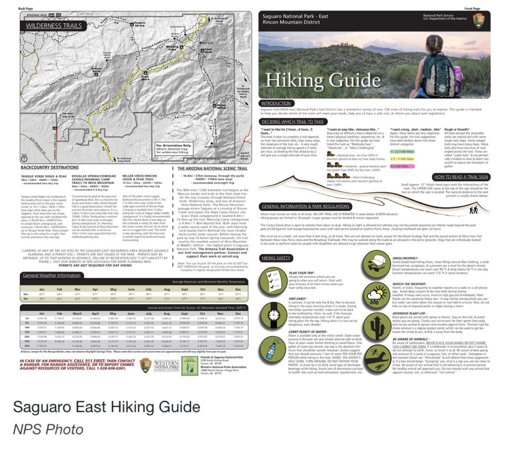
Saguaro National Park East

Saguaro National Park is so incredible there are two separate parks which book end Tucson, with over 175 miles of trail combined. Driving distance between the two parks is 33 miles, however with Tucson traffic plan for at least an hour. Each park has its own character and Visitors center. The Saguaro East Park encompasses the Rincon Mountain District.
Backcountry camping is available with a permit, which can be attained from the visitors center. A vast number of trails makes it possible to create loops of varying lengths and difficulty level. The high peaks of Mt. Mica mountain (8666′) and Mt. Rincon (8482′) allow hikers to experience woodlands. Pine forests, consisting of Ponderosa pines and Douglas firs, combined with scrub oaks, contrasts with the low elevation cactus desert.
An eight mile paved park road provides access to breathtaking views of forests of Saguaros. There are several areas to stop and immerse yourself into the surreal landscape. Many trails, provide wonderful loop opportunities. There are several shaded picnic areas. In addition, there are several trailheads which can be accessed from outside of the park. Douglas Spring trailhead was our favorite starting location and we hiked most of the trails in the area.
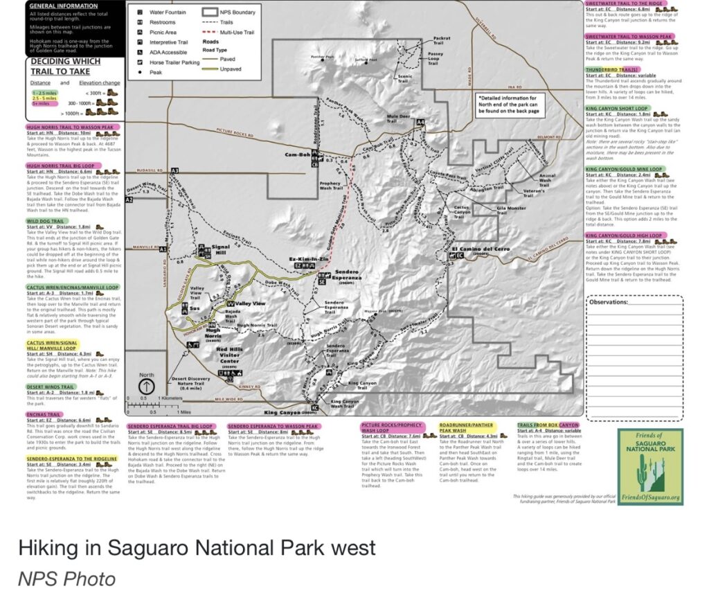
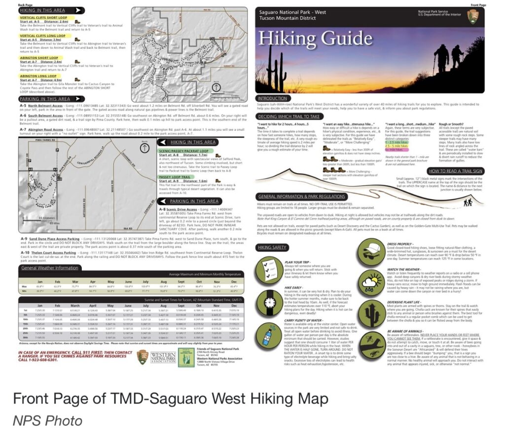
Saguaro National Park West
Saguaro National Park West encompasses the Tucson Mountain District, because our home base was across the city we only visited a couple times. In the future we hope to spend more time in this incredible park maybe when we are camping closer. The visitors center is large and informative. There is a cactus garden trail and a short wash trail which both begin at the visitors center.
The unpaved Bahada loop drive is about a five-miles and suitable for passenger vehicles. RV’s, or vehicles pulling trailers are not recommended. Our Subaru Crosstrek easily navigated the well maintained road. There were several pull-offs and picnic areas. Signal Hill picnic area provides access to see several petroglyphs left behind by previous inhabitants.
We enjoyed our loop hike to Goulds mine. As in Saguaro East a vast network of trails allows you to create various loops of all ability levels. Wasson Peak (4687) is the high point and can be reached from several trailheads. The wildflowers were putting on a beautiful show when we visited.
Picacho Peak State Park
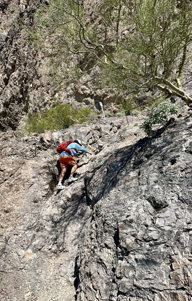
Picacho Peak is a crazy hike, at Picacho Peak State Park. I say crazy because this is the first cabled climb I have ever hiked. It was amazing and exhilarating! We hiked to the peak via the Hunter Trail. It’s 2.8 miles round trip with over 2100′ of elevation gain. I would describe this as a climb more than a hike. After ascending to the saddle you cross to the back side of the ridge and quickly descend to a lower level using fixed steel cables.
From this level the trail climbs gradually at times over rocky drop-offs and then steeply with the assistance of fixed steel cables you can hold on to. These cables provide more comfort than actual safety. We did not have harnesses on and were not clipped to the cables. It was up to us to hold on tight and watch our step. Jess and I both love a challenge and new experiences and this hike checked both boxes.
This was a difficult hike, which I would only recommend to a seasoned hiker who is steady on their feet and not bothered by heights. If this sounds like you then get out there and enjoy it. It will forever be one of my favorites. Watch our video of this amazing hike.
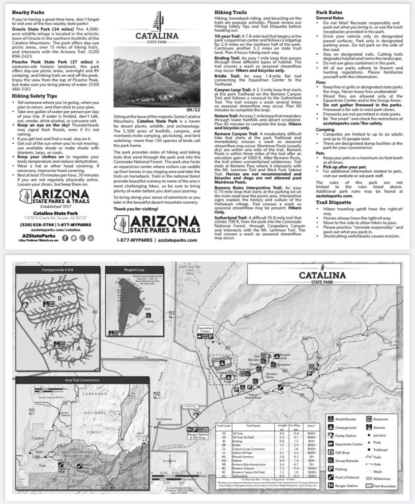
Catalina State Park
We were traveling from New Mexico to Camp Verde, Arizona last fall and decided to stop in Tucson. We stayed one night at Catalina State Park on a very hot Tucson day. Temperatures exceeded 105 degrees by the time we arrived and set-up. We were not expecting such high temperatures and decided it was best if we just enjoyed a good movie in the comfort of “Voyager” (our Leisure Travel Van) air conditioning.
We hear wonderful things about the trails in this State Park. Catalina State Park is on the western side of Mt. Lemmon and across the city from where we were staying near Saguaro National Park East. We drove in this direction a couple of times and traffic caused significant travel time over short distances. After frustrating drives we decided to book another trip at a different time, to explore everything this park has to offer.
Tucson Mountain Park
Tucson Mountain Park is another park on the west side of the valley. It has miles of hiking and mountain biking trails. All of which we have not yet visited. These are the Tucson mountains which form the range on the western side of the city of Tucson. I hope in the future when we visit Catalina State Park we can play in this area as well.
Hiking Tucson
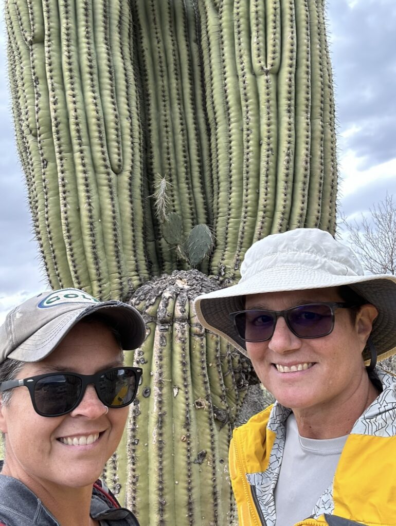
Tucson has a variety of hiking and a lot of it. Alpine forests, gentle grasslands, Sonoran desert scrub and so much more. Trails which will test your courage and others which will test your lungs. We were immersed in saguaros, ocotillos, cacti, pines and junipers. At the right time of year you can find the creeks flowing with snowmelt from above.
We loved hiking in the Tucson area and are excited to return. I hope these maps will help you if want to hike in any of these places. There are trails for all ability levels. I encourage you to get out there and take a hike! Live Simple Live Happy