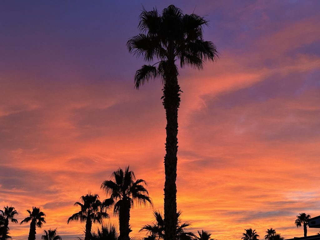
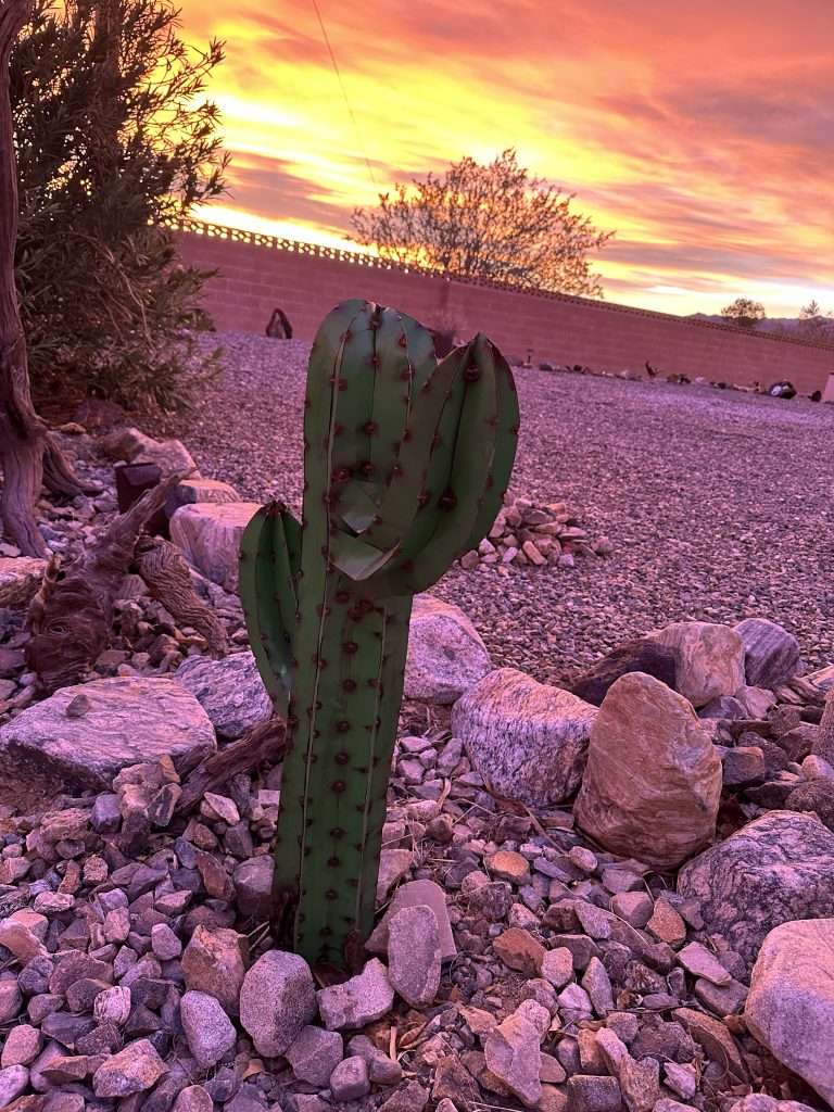
The sunrises and sunsets in Desert Center, CA are magnificent! This was our first trip to anywhere in California. Our destination: Joshua Tree National Park. At first glance Desert Center is the perfect home base to explore Joshua Tree. It is less than twenty miles from the southern entrance. But, as we learned, Joshua Tree National Park is huge, and the majority of the hiking is in the western and northern areas of the park. Therefore, we would need to drive an hour or more to reach many of the hikes.
As these realities set in, we pivoted and decided to alter our exploration to include areas outside of the park as well. We talked with locals, who we met at the RV park, and followed-up with our own research. We made a list and realized there is as much to see and do outside of the park as in it.
Additionally, the cost of gas at the local station is significantly higher. We saved money traveling the hour or more to the next closest cities of Indio or Twentynine Palms to fill up. This led us to combine shopping, re-fueling, and hiking adventures together, saving us both time and money. Our overall experience in Southern California was awesome! There is still a lot for us to see, but we made a good start!
Indio Badlands
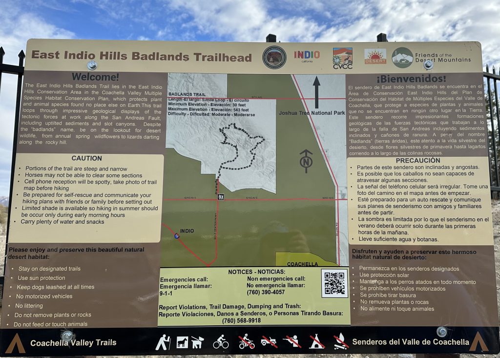
East Indio Hills Badlands Trail checked off a lot of “firsts” boxes for us. It was the furthest west we had traveled at that point. Our first hike through the San Andres Fault. Coincidentally, an earthquake happened while we were there, another first. The earthquake was small and a couple hundred miles away. However, my mother heard about it, knew where we were hiking, and called us to find out if we were safe. We never felt a thing. The amazing slot canyon we hiked through was also a first.
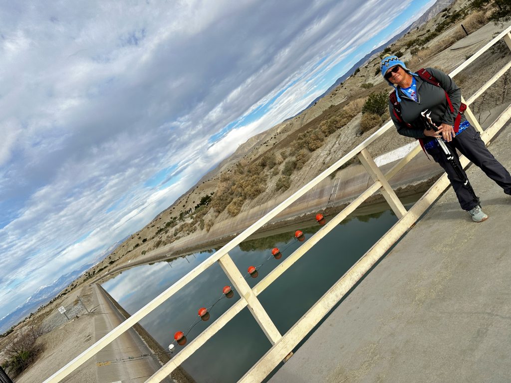
Just as the hike began, we crossed over the canal bringing Colorado River water from Lake Havasu and the Parker Dam to Southern California. The water has traveled a significant distance, and been pumped up many feet in elevation at several stations along the way to get to this point. This is a new concept for us. We are from Maine and we have drilled wells for most rural water supplies, as well as many municipal water systems. Reservoirs and canals, are not common. It’s amazing to see the difference, and the amount of work to provide water to communities.
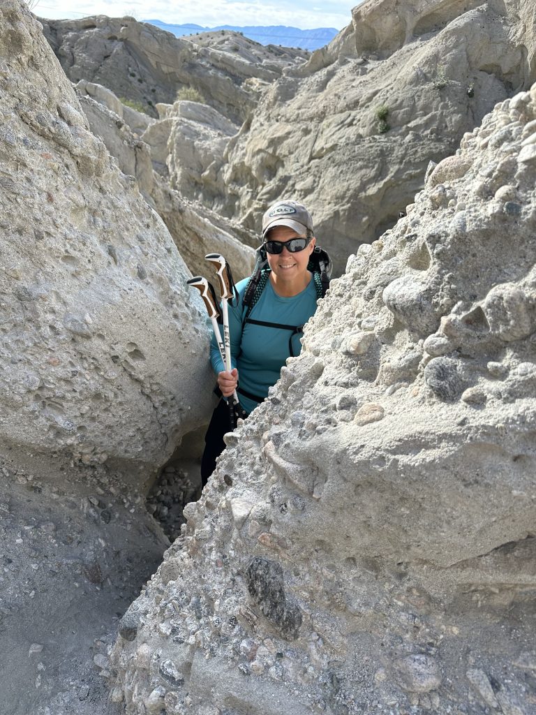
The trail is just over five miles and climbs about 800′. It twists and turns through an incredible pallet of colors and textures. The many layers of rock are folded, moved, and uplifted. Different geological features are visible along the hike. The canyons width varies, and is extremely narrow in some areas. We wound our way along the trail, and were certain we were traveling in circles.
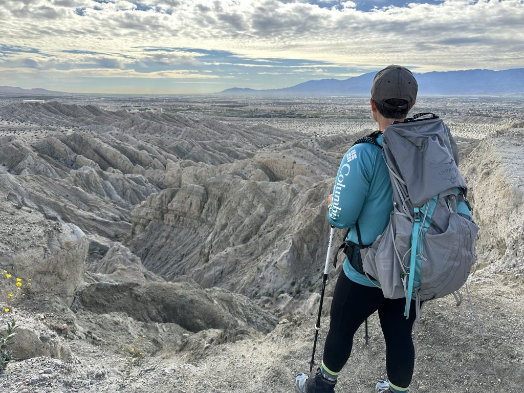
As we continued, the trail climbs to high ground and we could see into the area we had been traversing. It was amazing! One of our favorite hikes.
Bump and Grind Trail
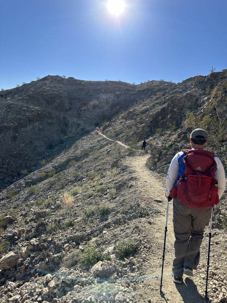
Yes, I picked this trail for two reasons. Firstly, the name. Secondly, parking for the trailhead was behind the Target shopping plaza. This is the time I have ever driven to the city and parked behind a business to hike. Usually, we drive away from the city! It was the perfect hike, because we needed to also re-stock and re-fuel. The trail is four miles long and gains about 1100′ of elevation.
Surprisingly, it was an extremely busy trail with hikers, bikers, and trail runners, all enjoying the trail. The footing of the trail was excellent and ascended up beautiful terrain, allowing us to see significant distances. We even spotted a small group of Big Horned sheep.
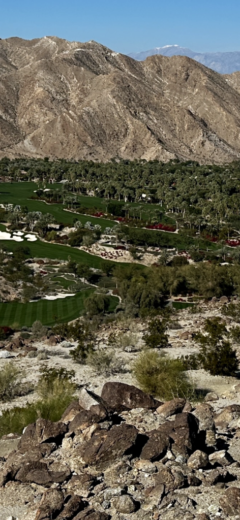
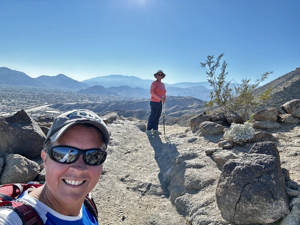
We took the picture above, as we hiked to the high point of the trail. An incredible view of San Gorgonio Mountain 11503′ in the background. In the foreground, one of the many meticulously groomed golf courses. If golfing is your thing, there are more than 100 golf courses in the Palm Desert area. A great hike and shopping day combined!
Box Canyon
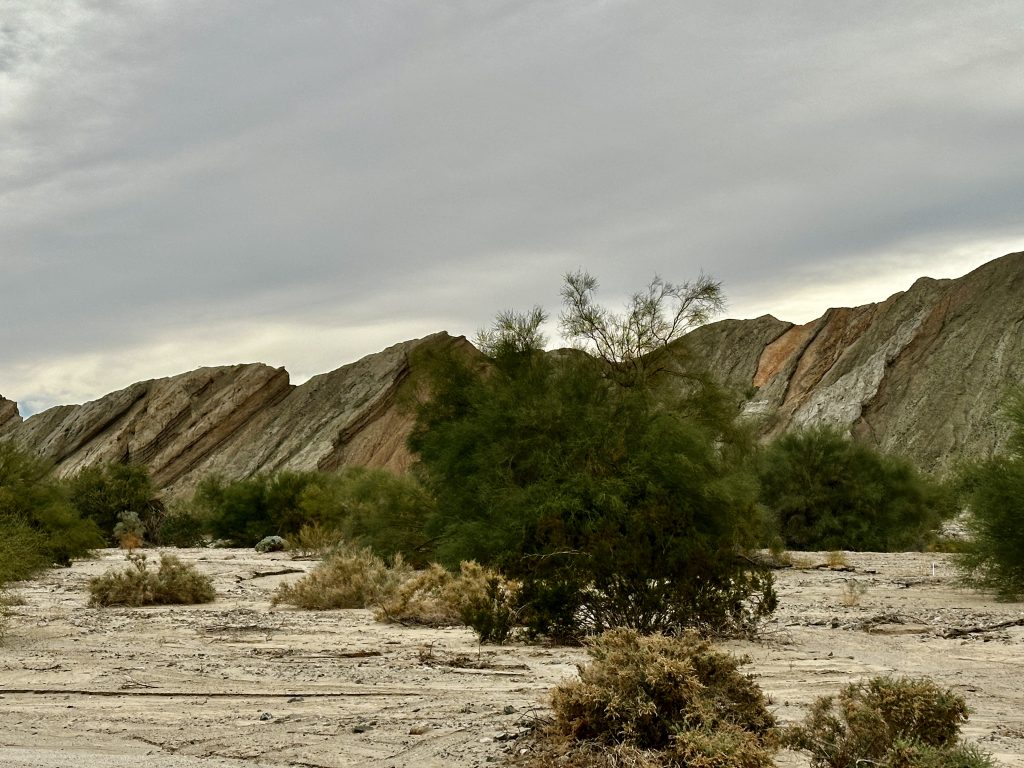
Box canyon was an unexpected surprise. We were driving to explore the Salton Sea area and Apple Maps routed us from I-10 across Box Canyon Road. Less than a mile into the canyon we had already stopped to take several pictures. It was like nothing we had ever seen. The canyon walls were tall, slanted and, twisted all at the same time. Additionally, the width between the canyon walls was expansive, a few hundred feet apart in many areas. The road followed the path of the canyon floor, basically the wash. We have hiked through wide washes before, but never anything this big.
Because of recent rains the wildflowers were also blooming. It was an amazing sight. This canyon is part of the metamorphic zone of the San Andres Fault. Basically, that means that rocks in this area have been altered because of a variety of geological processes. The length of the canyon is about eight miles long and is a delight to explore. However, be very careful pulling off the road, the soils are extremely soft.
Stuck

When we rounded a turn in the road, we noticed a Mercedes camper van stuck in the very sandy soils along the side of the road. We stopped to offer assistance to the frustrated couple trying to dig themselves out. I wasn’t sure we would be able to help, but I had an idea. I had a very small shovel and, a secret weapon, our floor mats!
We dug underneath the buried back tires of the van, and placed the mats. Then tried to move the van, amazingly it moved a few feet before sinking in the sand again. It took several placements, and short gains before finally reaching solid ground, which allowed the van to drive out under its own power. They were very thankful, and I proved a theory. I hope we never get into the same situation, and have to use the process for us, but at least I know it will work!
Coachella Valley

It was a beautiful day and our windows were open. As we approached the end of the Box Canyon road, we thought we could smell lemon. Around the next turn a marvelous sight, lemon trees as far as we could see, the smell was wonderful. As we continued driving, there were entire fields of various vegetables, fruit trees, and date palms. What a sight, fields of huge palms weighed with the dark colored dates almost ready for harvest. Amazingly, this area in Southern California produces the most date palms in the US.
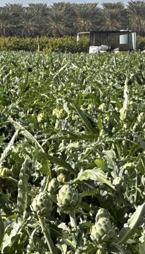
Availability of Colorado river water and consistent sunlight ensure optimal growing conditions year round. As well as the presence of fertile soils created because of millennials of sediment build up. Many vegetables thrive including, onions, peppers, garlic, spinach, cauliflower, artichokes, carrots, as well as dates, melons, citrus trees and tomatoes. It is one of the primary winter produce supply areas of the US. The valley was an amazing contrast from the primarily grey and tan rocks we had just driven through in Box Canyon.
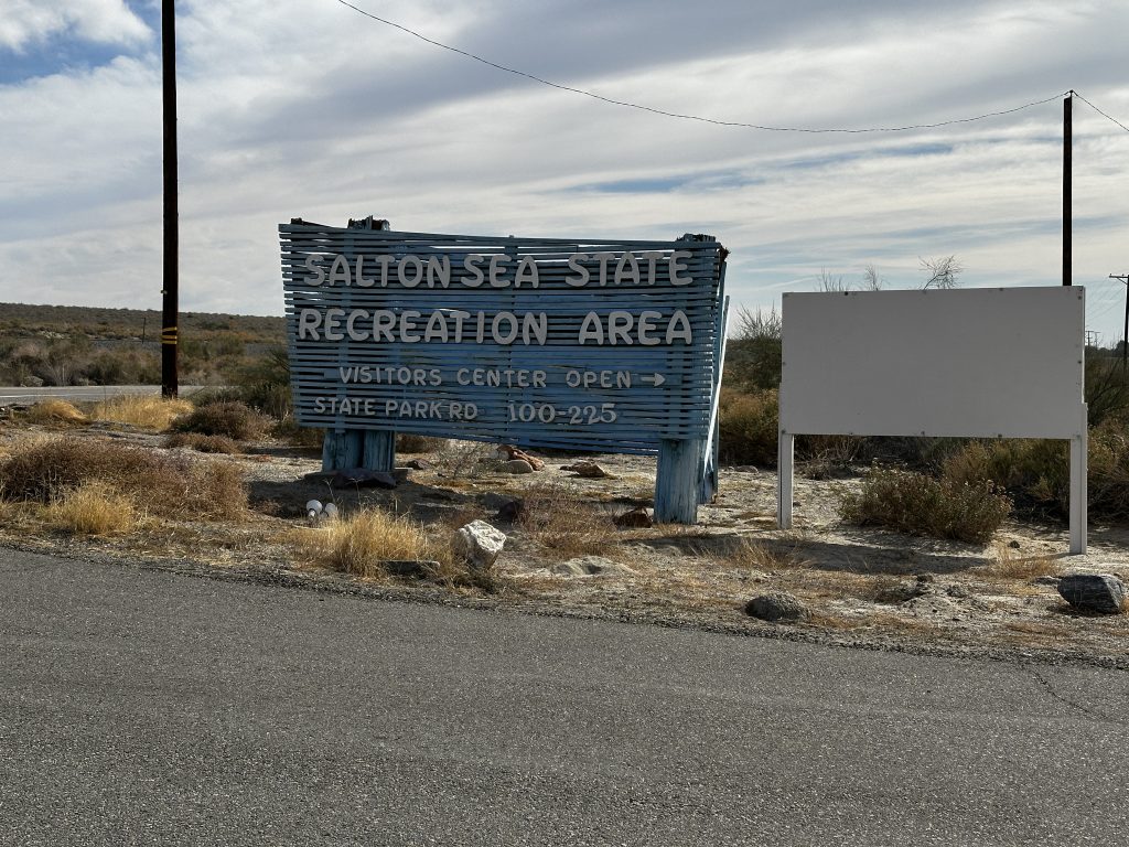
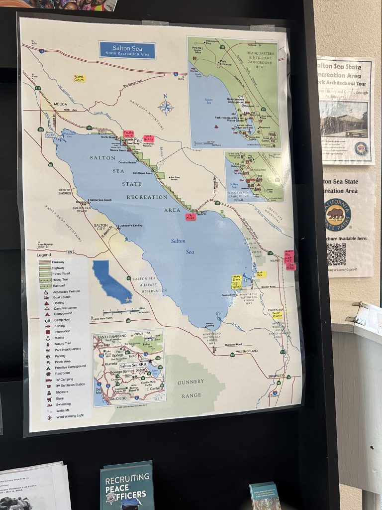
Salton Sea
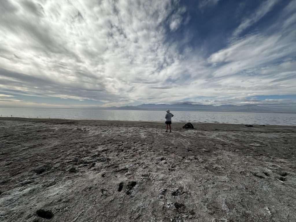
The Salton Sea is 228′ below sea level. The Sea is located in a subduction zone of the San Andres Fault. When tectonic plates collide, and one rides over the other, it creates both mountains and subduction zones. The Sea is forty-nine miles long and twenty miles wide, it is California’s largest lake. It was a popular resort destination in the 1950’s and 60’s. Attracting many celebrities who were able to enjoy water sports and fishing. At its height there was a fifteen lane boat ramp.
Unfortunately, as salt levels in the sea rose and the water levels decreased, so did the local communities. In 2020, the salinity level of the Sea was 7.4%, compared to 3.5% in the Pacific Ocean. The Sea is a basin and has no outlet. Irrigation run-off from both the Coachella Valley and Imperial Valley, re-charge the Sea, replacing water lost to evaporation. Salinity levels will continue to rise without intervention.
The Salton Sea National Wildlife Refuge is one of the most diverse refuges in the United States. It is an extremely important area for migratory birds and home to many fish species, despite the high salinity levels the water is very clean. Efforts are on-going to protect the Sea, and reduce additional environmental damages.
History
The Salton Sea has quite a history. Originally it was part of the Gulf of California flowing all the way to the Colorado River. Over time a silt dam developed, creating an inland Sea. Over hundreds of years fresh water from the river, replaced all the salt water, creating Lake Cahuilla.
About five hundred years ago, as the climate changed the lake began to dry up. Once the lake was dry, miners harvested the salt, and farmers began farming the fertile soils. They dug irrigation canals from the Colorado River. After excessive rains, in 1905 the river flooded, and broke through the side of the canals. It took eighteen months to fix the canals. During that time, it re-filled the Salton Sea.
During our visit, we explored the visitors center and walked to the Sea. The closer we got the more we sunk into the soil. We stopped when we were about ten feet from the water, because it was getting deep. The soil was a mix of fine sands and small shells, similar to what we would find on many ocean beaches. Another amazing sight in the dessert.
Bombay Beach
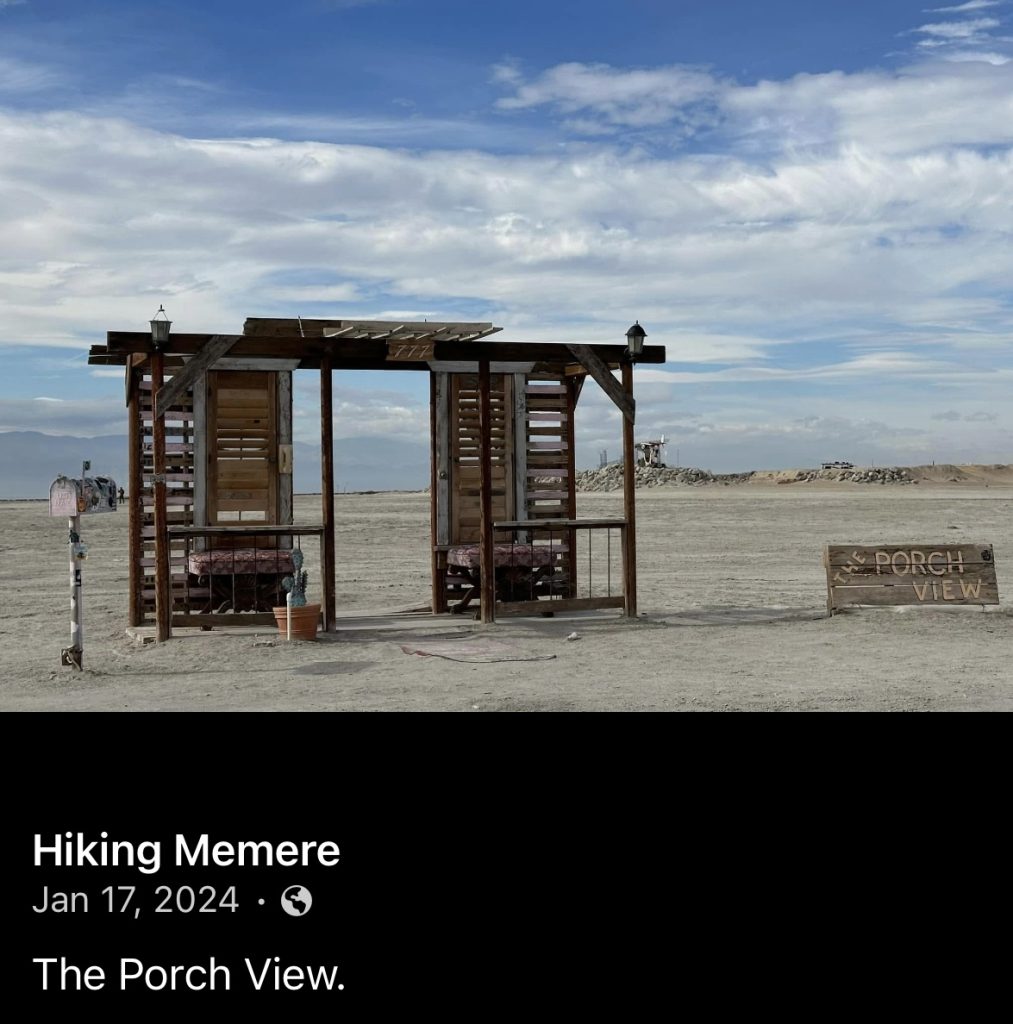
Bombay Beach’s past, has varied as lake conditions have changed. A busy location in the 50′ and 60’s with hotels and restaurants. But, as the Sea declined so did Bombay Beach, in the 1980’s many business and landowners abandoned the area, turning it into a ghost town.
Later artists began to move to the area and re-populate the community, in 2020 there were just over two hundred people. The art installations they created on the beach itself, as well as in the community are why people like us are visiting. We became aware of the eclectic sculptures and wanted to see for ourselves. This is a place where controversial issues are displayed front and center, in curious ways. The art is amazing, current, and makes a statement.
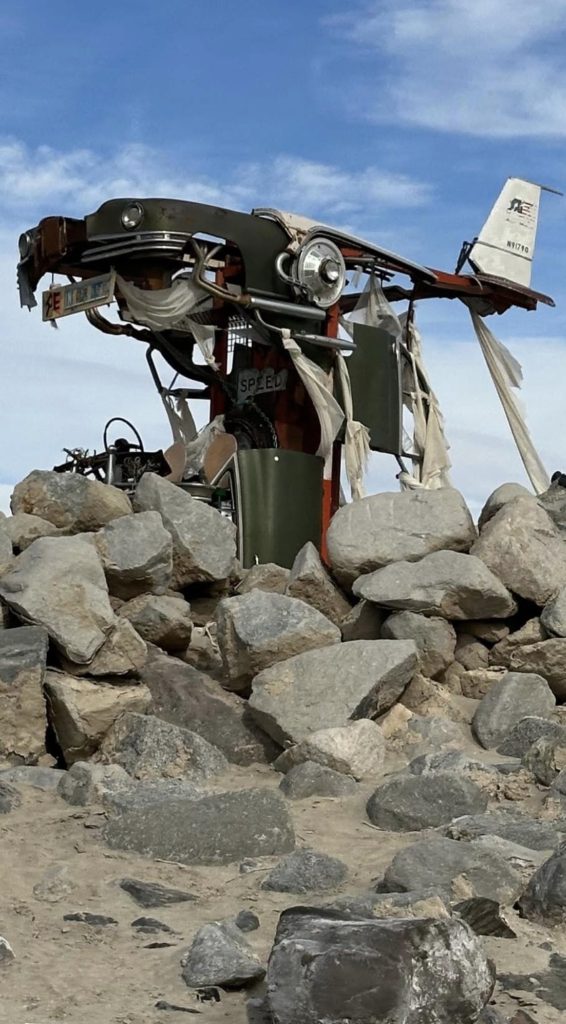
These are just a couple of photos, we took so many more. Prior to our visit, I researched the area and it was difficult to find information, and directions. We located the access road to the beach, through a small rundown community. I cautiously, drove out onto the sand to explore the larger than life displays. The driving surface was good and we saw a couple other cars exploring like us.
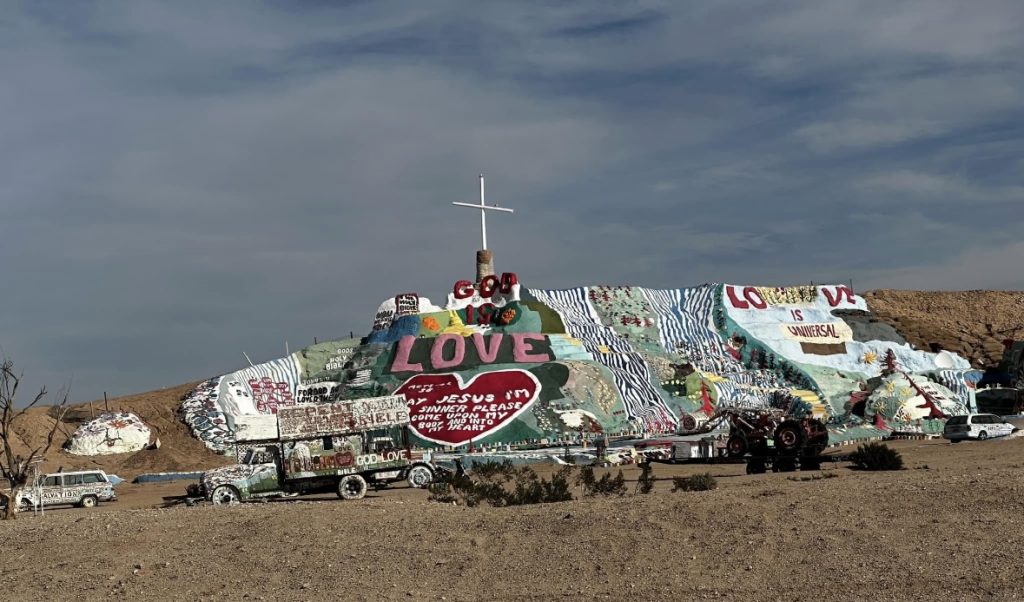
Salvation Mountain
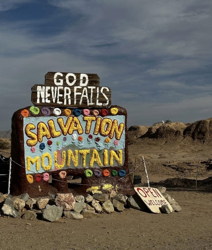
Salvation Mountain was our next stop, just down the road from Bombay Beach. It is a man-made mountain, fifty feet tall and one hundred and fifty feet long. Local resident Leonard Knight created this mountain from adobe bricks made with local clay, over thirty years. Regardless of your religious beliefs, the statement is simple. “God is Love”. When you get close to the structure, its amazing to see the details flowers, trees, rivers as well as scripture versus and prayers.
Salvation Mountain is just north of the town in Niland, California and just outside of Slab City. The artist passed in 2014, and a volunteer group took over the operation of the location. In the year 2000, the mountain became a folk art site. It has received many accolades over the years, and has been featured in music videos and films.
Slab City
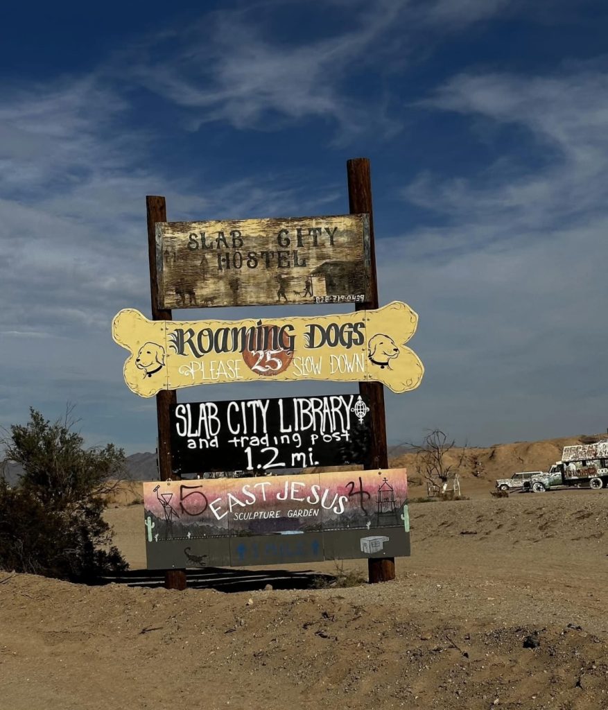
Slab City is the remains of a military base which operated here during WWII. When the base was decommissioned and the buildings removed, the concrete slabs remained, thus the name. In the mid 80’s the area became popular because of an article written in an RV’ing magazine. Primarily “snow birds”, RV’ers traveling here from cold weather locations during winter months, populate the area. As many as two thousand RV’s are spending time here from October to May.
The area is often referred to as an artists commune and squatters paradise, in a lawless community. The last truly free place to live. There are no public utilities, including electricity, water or sewer. Fresh water is available at the community church pictured below. There is also a Free Library. We drove many of the streets and to say I’d never seen anything like it is not enough.
There are many opinions about Slab City and its inhabitants. I read several things relating to drugs and other criminal behaviors. We visited during the day and stayed primary on the main roads in our vehicle. We felt safe and had no issues, but like any other unfamiliar place. I would not be exploring after dark or pestering inhabitants.
Mud Volcano’s
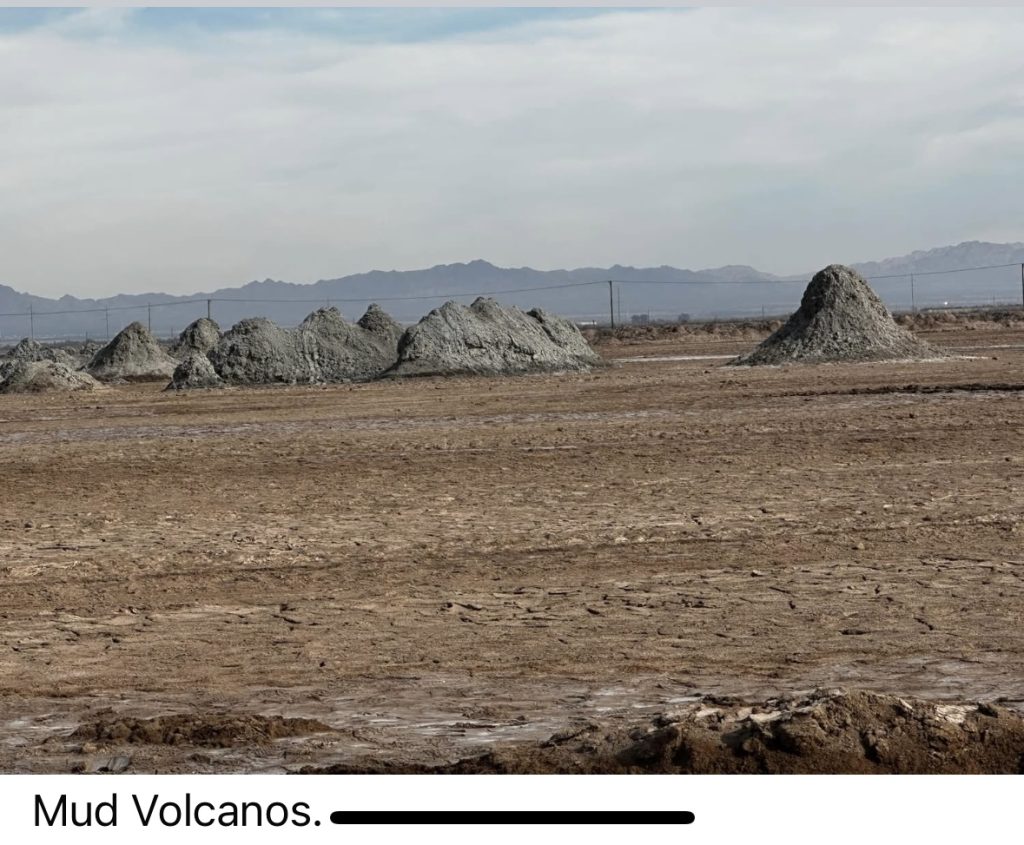
South of the Salton Sea are several geo-thermal energy plants. Geothermal energy is created by using the Earth’s natural heat to boil water, and produce steam to then turn generators. The cool water is returned to the ground in a renewable process. This is where we found the mud volcanos.
It was a long bumpy ride down several washboard dirt roads, passing many private property signs along the way. Because, the volcanos were listed on the Park map we had taken a picture of, we kept driving. We snapped this picture from the car when we discovered their location.
I read a lot of confusing information about the area. Because, I am not positive exactly what we were looking at. I believe this area is referred to as the Davis-Schimpf Seep Field. The formations are created from carbon dioxide bubbling up through mud, not actually volcanos.
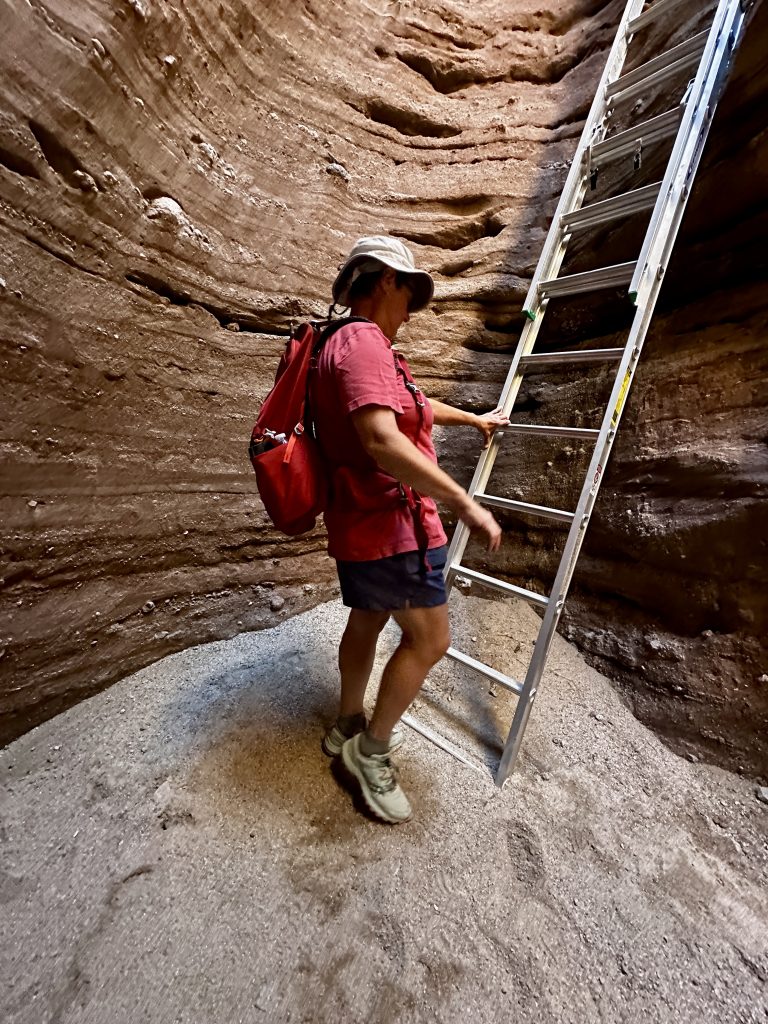
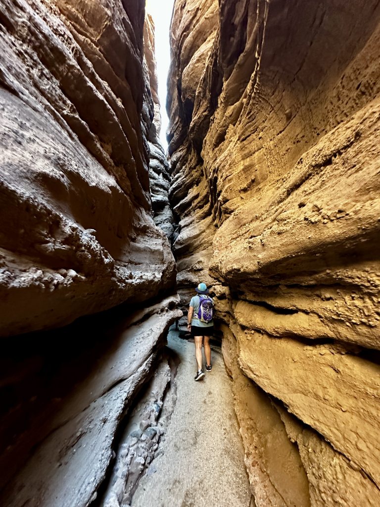
Ladder Canyon Trail
Everything about the Ladder Canyon Trail filled me with apprehension. It was one of our last hikes in the Southern California area. I read every description I could find and became more unsettled, primarily because of conflicting information. The access road conditions were confusing and the descriptions of the canyon were vastly different. People talked about missing ladders, and getting lost, even the best direction to hike the trail was aggressively argued.
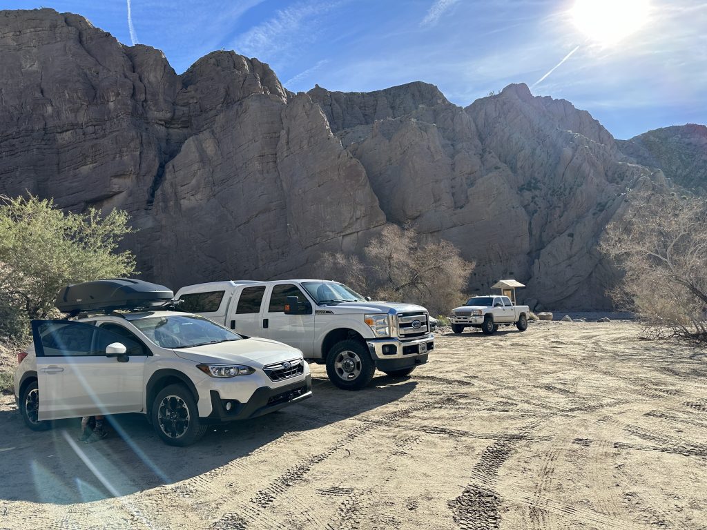
Jess and I decided to try to find the road, then the trail, and take it from there as we felt comfortable. The directions led us from I-10 to Box Canyon Road to a right on Painted Canyon Road, which had no sign. The first part of the dirt road was in good condition and solid, but as we proceeded the road became sandy and with deep ruts. After several miles we caught up to other vehicles and simultaneously we saw other vehicles pulled off the sides of road.
At this point, I was afraid to stop. The sand looked too deep, and I was positive we would get stuck if I stopped. I asked Jess for her opinion and we decided to keep going. The trailhead was supposed to be five miles and we were getting close. When there was a fork in the road, both choices looked bad, with people stuck in each direction. I chose the road to the right and stayed steady on the accelerator. The ruts were so deep now that they were occasionally hitting the bottom of the car.
I knew if I stopped, I would be stuck. There was no place to turn around. My only choice was to continue forward. I was relieved when I saw an area with other vehicles parked in the distance. The sand was solid again. We made it to the trailhead.
Our Surprise
We were thankful and excited we made it to the trailhead, and then life got even better. A person called out my name, as we were getting out of the car. How could that be, we were in the middle of no where, and didn’t know anyone. Surprisingly, it was our neighbor from the RV park we were staying at. We had no idea she hiked. She was there with a group of women from the park. They asked us to join them. Wow! What an amazing coincidence. Karma appeared to be on our side today.
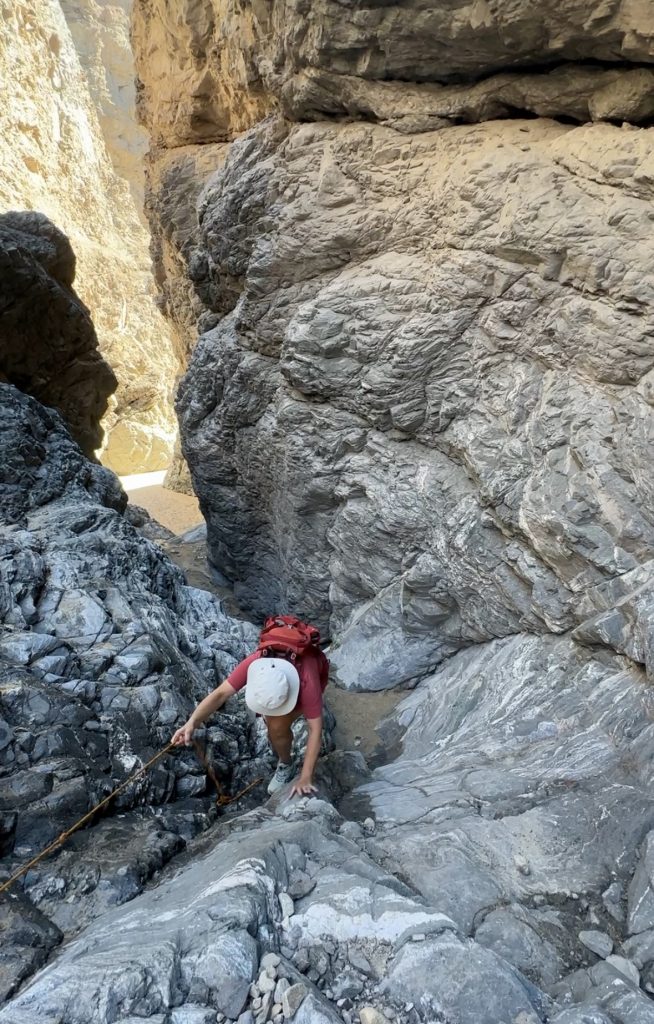
The hike is about 4.5 miles long with 900′ of elevation gain. However, there are many possible variations. Which is why there is so much conflicting information. We hiked in a clockwise direction, meaning we hiked primarily up the ladders and ropes and descended through the wash. I lost count of how many ladders, but they felt solid and were easy to climb. The canyon walls were tall and the textures of the rock out of this world. Our first true, extremely narrow, and very tall slot canyon.
When we eventually emerged from the canyon there was some additional climbing to reach the high point of the hike. Fortunately, it was a beautiful day as this part is all in full sun. We had plenty of water and layers of clothes for whatever we encountered. The hike out through the large wash was enjoyable, with lots of rocks to explore. We enjoyed a great hike, made new friends, and had a whole group of people who made sure our car made it back to the main road. What a day!
Rattlesnake
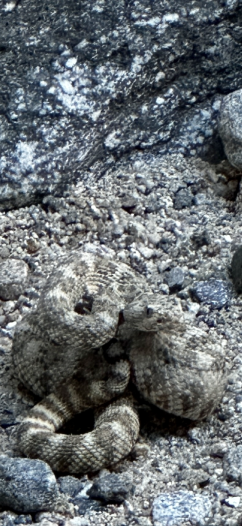
Rattle snakes are simply part of hiking in the dessert. Several types of rattlesnakes exist. Western Diamondbacks are the most common, however we have seen sidewinders, mohave rattlesnake, and Prairie rattlesnakes while hiking. Occasionally, we have also seen a bull snakes, a non-venomous snake that looks similar to a rattlesnake. Unfortunately, people improperly identify them and kill them. They are important natural predators of rattlesnakes. Rattlesnakes have triangular heads, and it’s the easiest way to identify them.
Rattlesnakes are venomous and a bite from one can be deadly, if not treated. Snakes are most active in warmer times of the year, as well as at dawn and dusk. We have seen the most snakes along the sides of trails, and under leaves and boulders. Rattlesnakes do not want to be near us anymore than we want to be near them. A rattlesnake will make a distinctive sound, if you get to close. This rattle is a warning, heed the warning and stay away for your safety.
The above picture is the closet encounter we’ve had. I was the first person descending a ladder in the canyon trail. I did not see him and thankfully did not step on him. He never alarmed and was first seen by the third person down the ladder. Jess snapped this photo from the safety of the ladder, before descending and allowing a wide birth between her and the snake. Amazingly, the snake moved into one of the creases in the canyon wall, and blended in perfectly. Now I’m even more careful about my hand and foot placements.
Amboy Crater
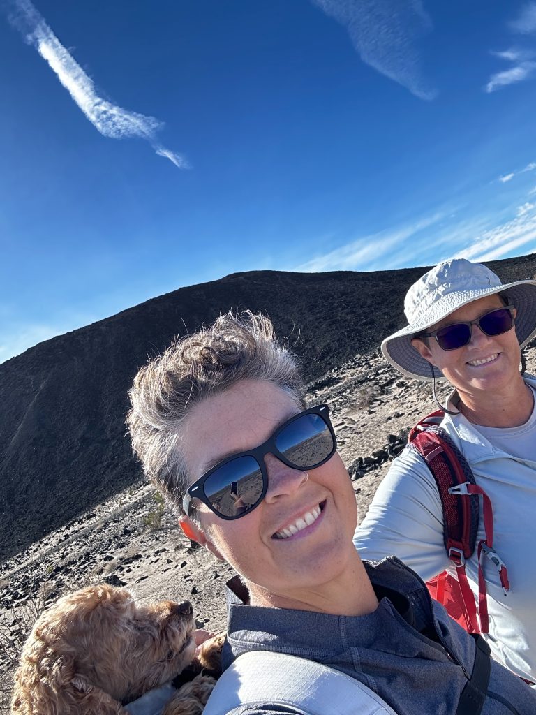
Amboy Crater is a volcano located in Amboy, California just a few miles off Route 66. It is a National Natural Landmark. From Desert Center it was a couple hour drive to the north through expansive desert landscapes. It is a cinder cone volcano, and its most recent eruption was 10000 years ago. It is one of the United States youngest volcanic fields. There is a day-use parking area with covered picnic tables and restrooms.
The Amboy Crater trail, begins in the day use area. It is approximately a four mile round trip, however there are many options. Teddy accompanied Jess and I on this hike. It was all of our first experience hiking a volcano. The hike begins by walking through a lava field. Then becomes a mix of sand and rocks. Despite being January, it was hot.
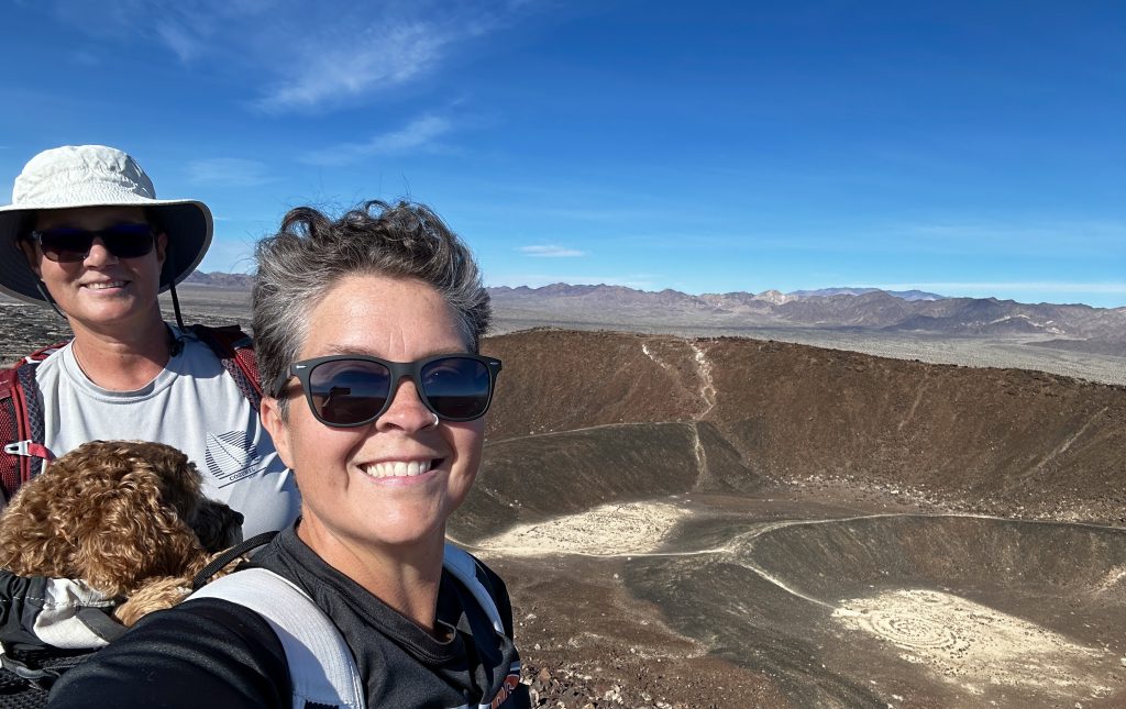
A series of switchbacks climb the cinder cone. There is a trail through the crater as well as one encircling the rim of the volcano. We explored both. The hike around the rim, provided 360 degree views of the amazing landscape and volcanic fields. Surprisingly the walls of the cinder cone were much steeper than the pictures indicate. Hiking into the crater was just as incredible. What a day!
Desert Art
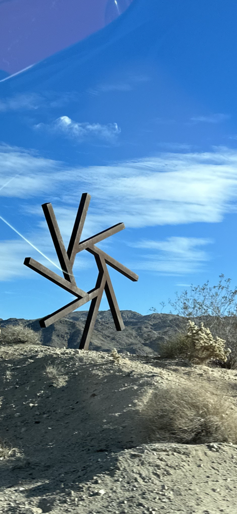
This sculpture is located along the side of the highway in Twentynine Palms, CA. It is just one of several art installations. The work of Simi Dabah a self-taught artist and welder. He has a studio in Los Angeles, CA. He creates art from scrap metals. His work ranges in size from just a foot, to over twenty feet. I loved it.
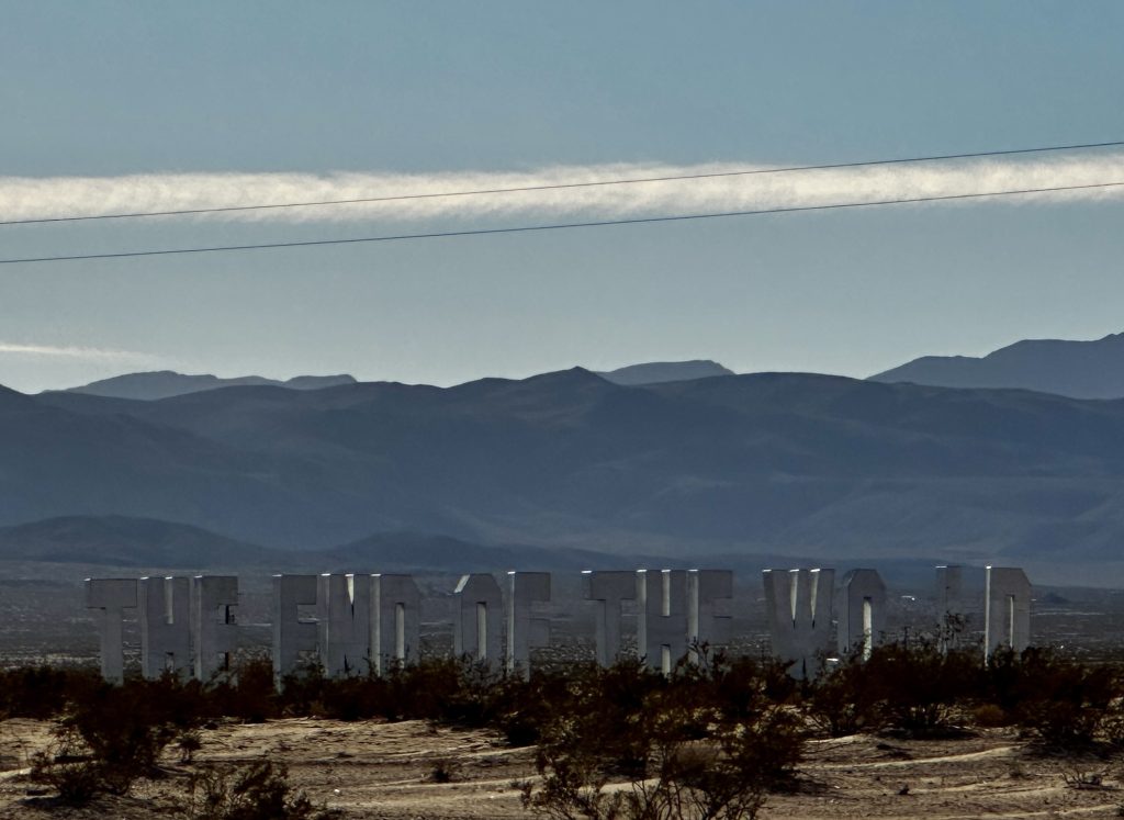
Another amazing larger than life roadside art installation. Artist is Jack Pierson.
Dessert Center is a small community with just over two hundred and fifty year-round residents. It is a little off the beaten path, but was a marvelous home base to explore Joshua Tree National Park and Southern California. Because of its location, it forced us to organize ourselves and incorporate our chores into our daily fun activities. This simple idea, changed the way we travel. Haircuts, oil changes, shopping, and laundry are a fact of life, we mesh them seamlessly with our life. I love spending a few hours hiking, getting some necessary chores done and still having time to write.
My favorite part of being in Desert Center is the amazing sunrises and sunsets. Roadside art, desert art, man-made mountains, amazing slot canyons, painted canyons, pristine dessert wilderness, snow covered high peaks, an inland sea, volcanos, and so much more. A best kept secret in Southern California and a great find for us. Live Simple Live Happy