Special Activities Recreation Area, SARA park is a treasure and a one-of -a kind place. The park encompasses 1100 acres of mixed use recreation for all, with more development planned. The origins of the park were difficult to find, but an article in RiverScene magazine written by Becky Maxedon summed up the beginnings.
Basically, she interviewed a long time resident who provided her with a first hand recollection explaining the parks beginnings. My take away from the article is that this same project if proposed today would probably never make it past the planning stage and definitely not be able to acquire all the necessary permits.
Like many attractions here in Lake Havasu, a local group spearheaded the project. In the mid-seventies a lease was negotiated with the Bureau of Land Management and a grant was obtained. The beginnings were tremulous with inexperienced workers and political hurdles. Possibly some services like access to water were completed by “dark of night”.
Today the park is owned and maintained by the city of Lake Havasu. Complete with many bathrooms with running water and an on-site camp host. Most of the activities in the park are free to participate in, with the exception of paid special events. Schedules and details available on their website. SARA park is the first place we explored when we first arrived in Lake Havasu.
Activities & Events
Havasu 95 Speedway
Havasu 95 Speedway is a paved oval track which meets ASA (American Speed Association) standards for stock car racing. Races are held in the winter months from September – May. A variety of classes race at the track from modifides, legends, factory stock, and more. Havasu95speedway.com provides details about future races and ticket prices.
BMX
BMX track requires membership in ABA (American Bicycle Association). Races are two days a week and spectators are free. The sport is very popular with younger adults riding non-motorized bikes around a track similar to motorcycles performing tricks along the way. Two separate tracks are available to provide options for less experienced riders. For the littlest riders the Strider Rider Balance Bike Track is the perfect playground for the next generation of future olympians to hone their love of the sport. Lake Havasu City BMX
Rodeo Grounds
The Rodeo Ground holds events featuring the GCPRA (Grand Canyon Pro Rodeo Association). A small fee is charged per event, which includes bull riding, bareback and bronc riding, steer wrestling, calf roping and more. Additionally the annual Winter Blast Fireworks show takes place in the rodeo grounds. havasurodeo.com
Sterling Field
Sterling Field (RC Plane & Helicopter Field) is home to the Desert Hawks Radio Control Club. An AMA (Academy of Model Aeronautics) membership is required. The newly remodeled air field is about 750′ long and 60′ wide. There is a separate helicopter pad and covered shaded areas for aircraft assembly. Visitors are welcome when the gates are open. For more information about events and fees visit deserthawksrc.club. In addition the park includes an RC Car Raceway.
Motorcross Park
Motorcross Park is a practice and race facility. It is a man-made track primarily suited to amateur and novice riders. I recommend checking their website or Facebook page for more information.
Roller Rink
Roller Rink in SARA park provides a unique opportunity to skate outside on a “ice” like surface. Several groups use the facilities, including men’s, woman’s, and children’s groups. Havasu skates is a non-profit group providing monthly free events available to the public. DJ’s , laser lights and fun, under the stars of Lake Havasu. Check their website for details havasuskates.com
Lake Havasu City Sportsman’s Club
Lake Havasu City Sportsman’s Club (Shooting & Archery Range) was established in 1971. There are five pistol ranges, two rifle ranges, skeet, trap, and 5 stand options, offering a variety of shooting options to challenge anyone. The ranges are covered and participants are required to provide all of their own equipment, including ammunition and targets, and follow all safety rules. Additionally, there is an archery practice range and walking range. A small fee is required. havasusportsman.com
Dylan’s Dog Park
Dylan’s Dog Park is a two-acre enclosed off leash dog park. There are separate sections for dogs above and below twenty-five pounds. Each section has grassy areas, walking paths, and covered benches. The park is open from sun-up to 11pm daily and is free to use.
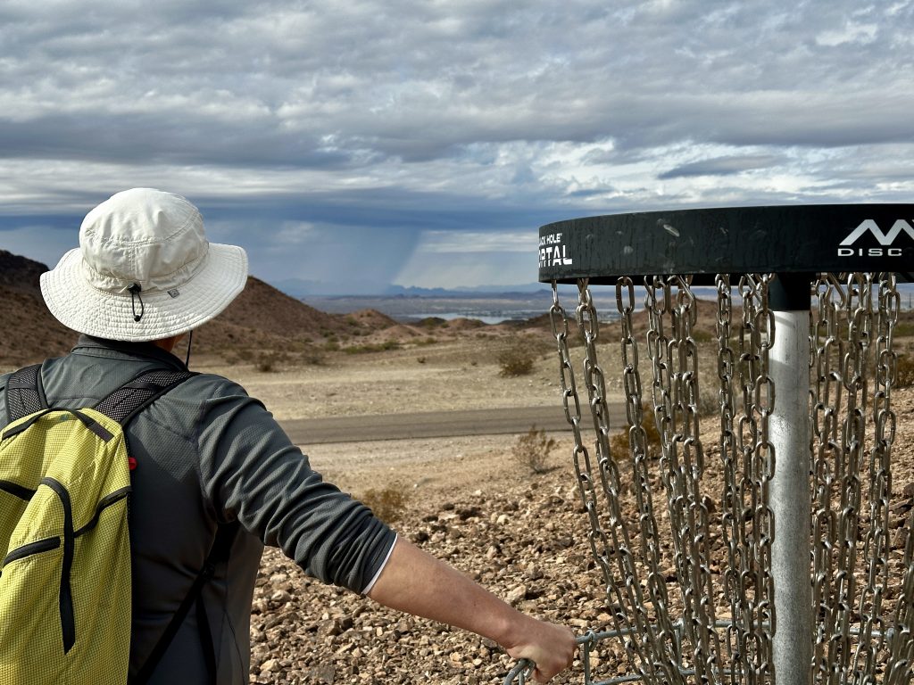
Disc Golf
A challenging 24-hole dessert disc golf course provides fun for the whole family. A mix of elevations and distances with interesting art work along the trail. Much of the path coincides with a mountain bike trail, where bikers have the right of way. Download the UDisc app for hole locations and distances, keep score right on the app.
Baseball and softball fields, Gigantic covered playgrounds, picnic shelters, with many restrooms with running water, provide endless entertainment opportunities for locals and visitors alike. To reserve picnic shelters and check schedules go to lake Havasu parks & recreation.
The Trails
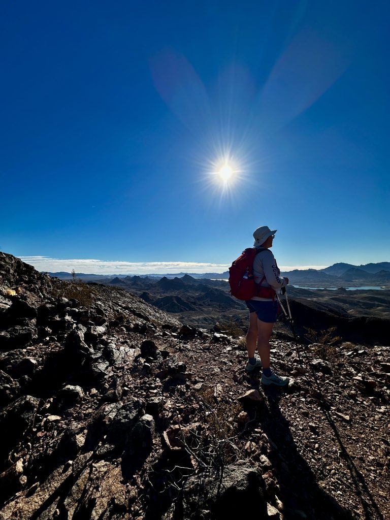
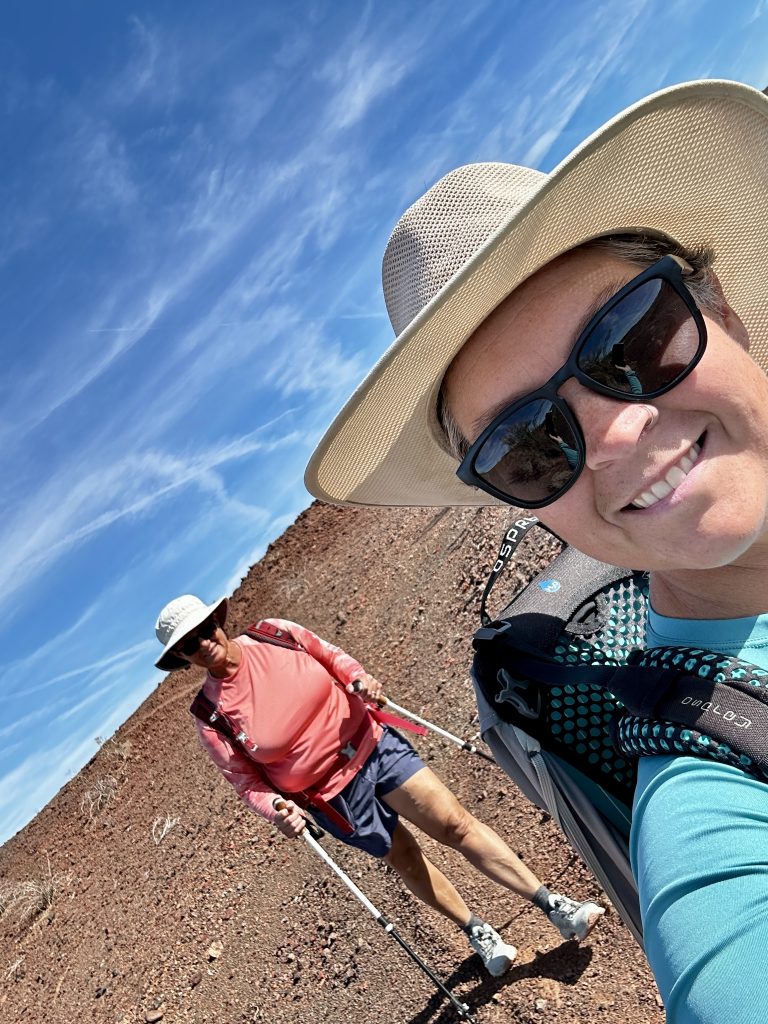
SARA park is home to our first adventure in Lake Havasu. Jess was working remotely full-time and our RV adventure was just beginning. The RV park we chose had a robust group of winter travelers, who participated in a variety of activities, one being hiking. I decided to hike with the group to learn local trails, then complete the hikes again at a later time with Jess.
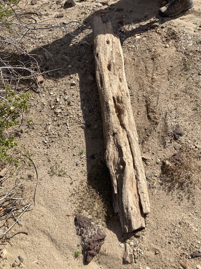
The group hiked to the Petrified wood. I wish I could tell you the trails to find it, we hiked parts of trails, over ridges, through washes and it amazingly appeared. I was trying to remember the route, but the monochromatic desert landscape all looked alike to me. Hiking in treeless, riverless areas was new to me. I did not know what a wash was or why all the rugged craggy points did not have names.
Hiking in New England, I learned to stay on trail. People who venture off trail typically find themselves in potential dire situations. Books chronicling harrowing survival stories of lost hikers, highlight the importance of staying on-trail. The fact that we were exploring wherever we wanted to go, regardless of trails, was uncomfortable. I realized how much I had to learn.
Sara’s Crack
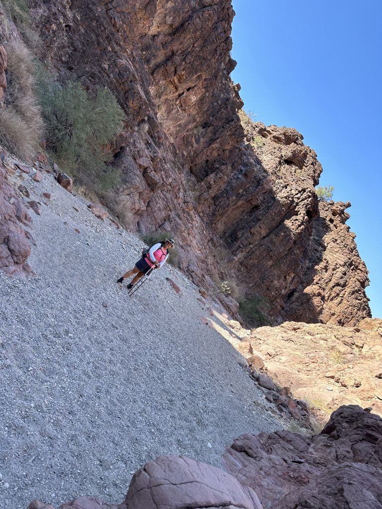
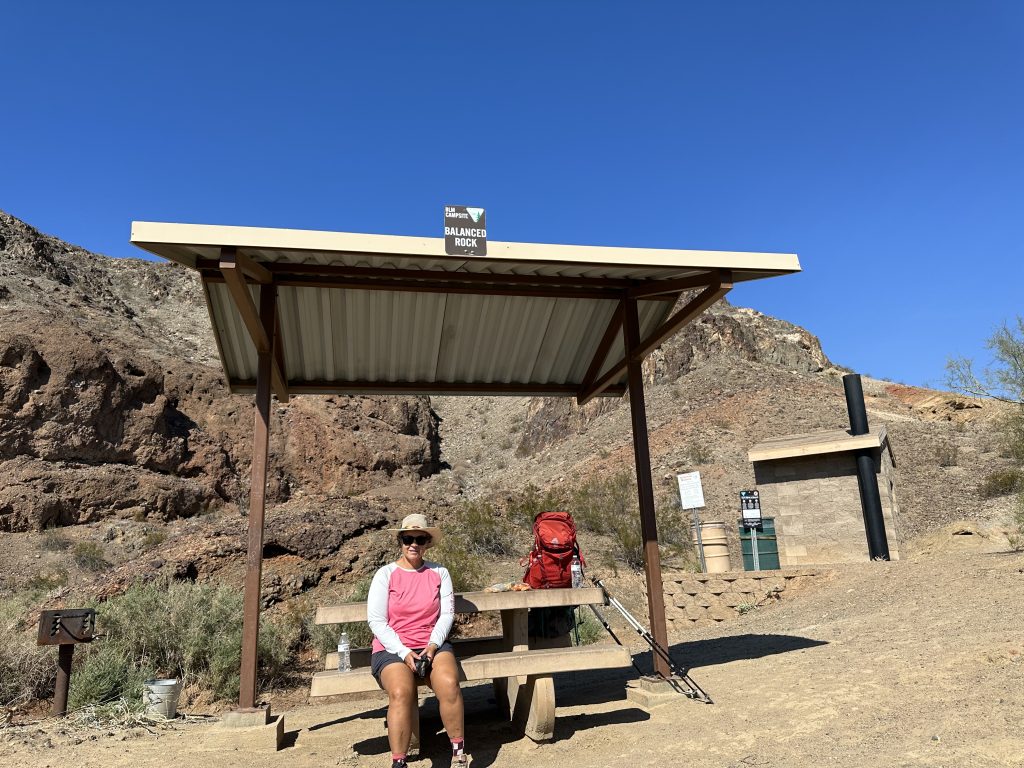
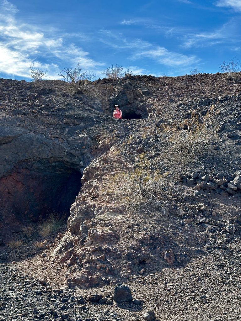
Sara’s Crack is our first hike and one of the most popular hikes in the park. Follow the link to view our hike. Alltrails lists the mileage at 3.4 miles round trip with an elevation gain of less than 300′. The trail begins from the first parking lot across from the Rodeo grounds. There is a restroom and map providing trail information. The trail follows a wash to the “crack” in the wall. Basically a wash is a dry river bed. When rain or snowmelt is present these washes are part of the natural path runoff takes from high grounds to low.
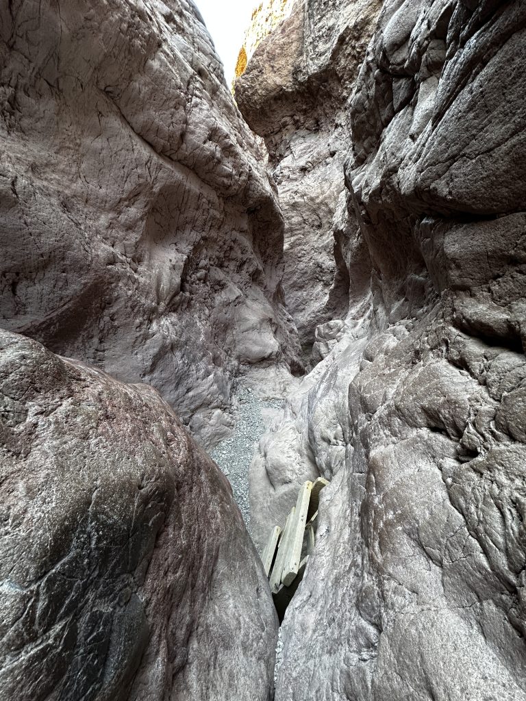
Washes and canyons are subject to flash fooding seasonally and in times of storms. It is important to be aware of weather conditions and realize a flash flood is possible even when it is not raining above your head. As we entered the crack we were in for a treat. The canyon walls rise steeply above both sides of the trail which narrows to just a few feet wide. The texture of the walls are a mix of jagged irregular outcrops and smooth polished surfaces, hinting to their formation.
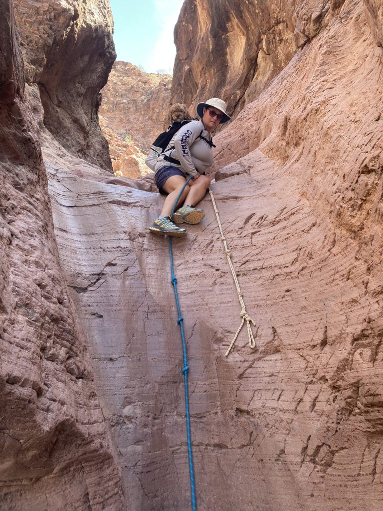
The section above is a steep, smooth waterfall. The permanent rope aids hikers ascending and descending the 8′ formation. Continuing in the slot canyon it is necessary to climb over and around many obstacles. The bouldering is not difficult with little risk of falling, however flexibility and a love of exploration is beneficial. The sunlight illuminating the canyon walls is a photographer’s dream.
I’ve lost track of how many times we have climbed through the “crack”. It has not lost its appeal! I find something new and amazing during every hike.
Balance Rock
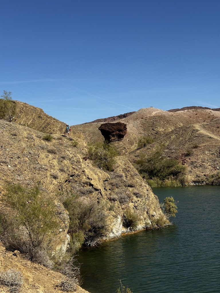
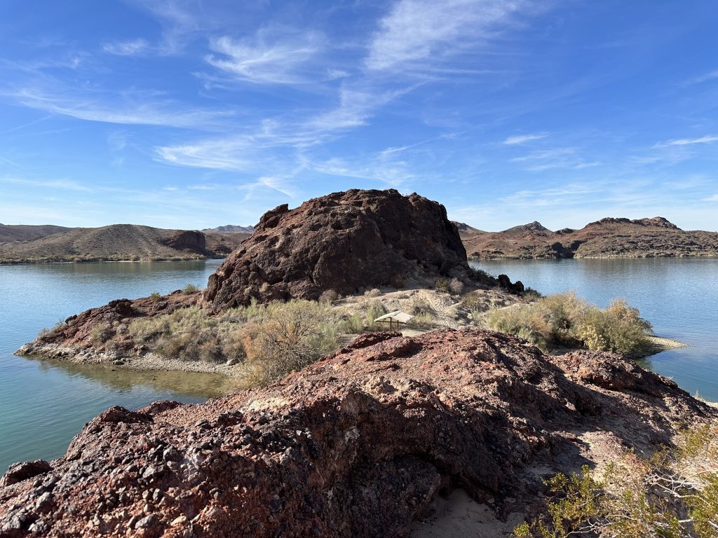
Balance rock is in the center of the picture above. It is located in Balance Rock Bay, the rock is about forty feet tall. Softer rock at the bottom of the structure has eroded away leaving the huge part of the rock seemingly resting on a pillar. We typically combine the “crack’ trail and hiking to the cove as a loop hike with a distance of about five miles and less than five-hundred feet of elevation gain.
There are several options and trail off shoots. In general the red and yellow trail through the crack and to Balanced Rock Bay and the blue trail to return to the main parking area. As in many areas of SARA park when we reached the waters edge there is a picnic table and pit toilet. These sites are available for camping and recreation with a fee.
The Lake Havasu Shoreline Sites are first come first serve. A pass can be purchased on recreation.gov however, the pass does not guarantee a particular site. If spending more than twenty minutes a one of these locations it is necessary to buy a day use permit. It is a great place for a quick snack before our hike back to the car.
Lizard Peak
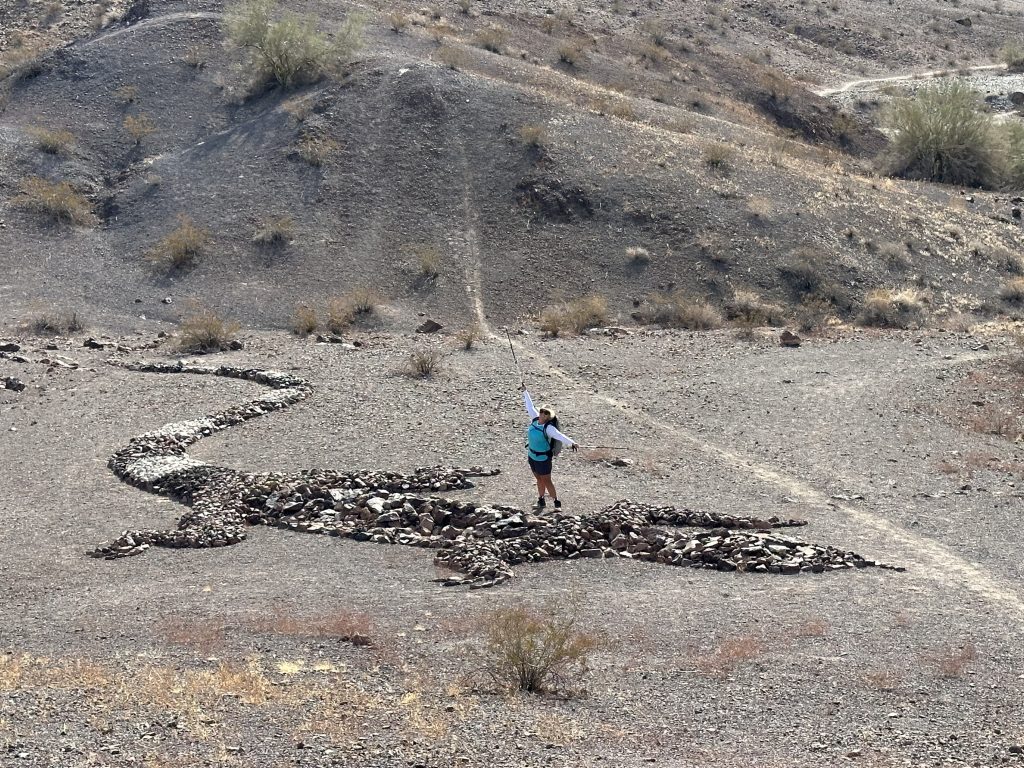
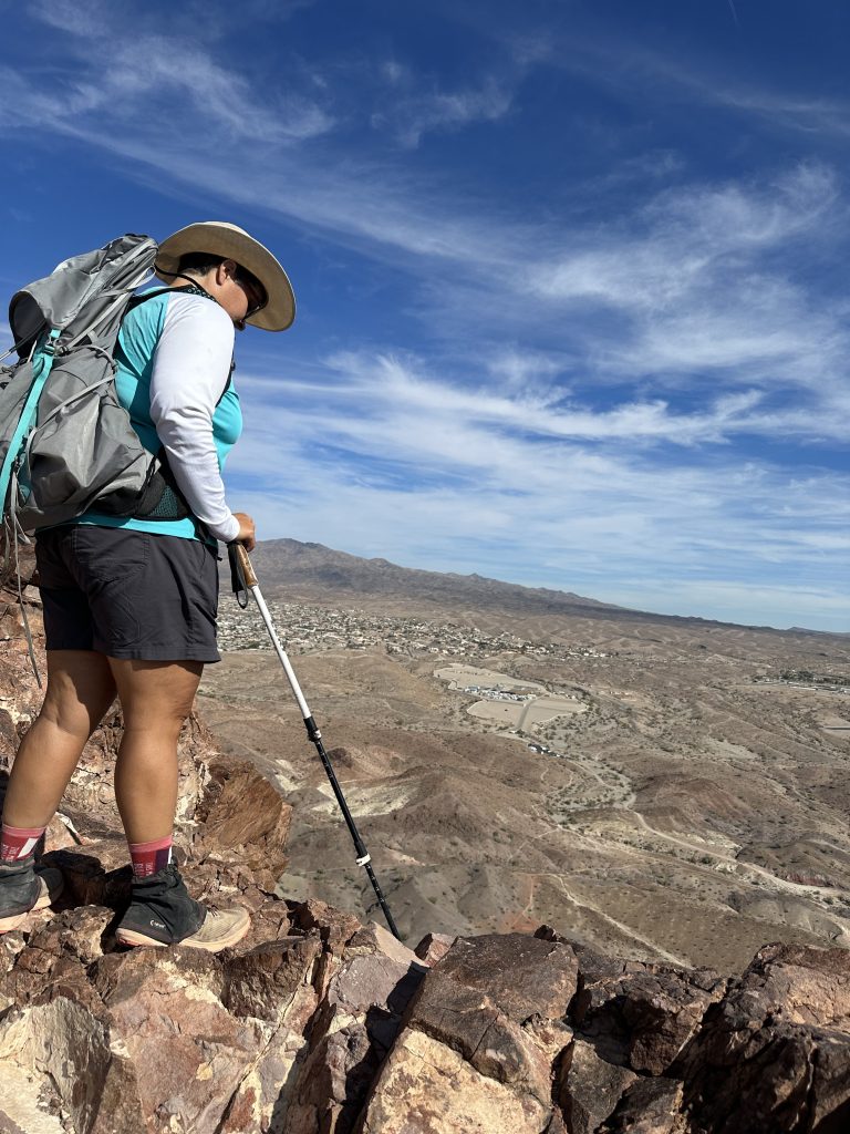
Lizard Peak is another popular hike in the park, to see our hike click the link. The peak is also referred to as Table top, because of the giant picnic table located on the summit. Amazingly, the picnic table was carried to the summit of the mountain with permission from the Arizona State Parks in the early 1980’s, by the Leaping Lizards Tribe. It has been repaired several times by the volunteer group, and is currently in beautiful condition.
Tim O’Connor and members of the Leaping Lizards Tribe are the group of people we have to thank for many of the trails in SARA park. In addition, they created the amazing 80′ long lizard which can be seen from the summit. The lizard is referred to as a geoglyph, a term I was unfamiliar with, basically it means some type of design using natural materials, which can typically be seen from great distances.

We have hiked Lizard Peak and other trails surrounding the peak in all directions several times. One of the most popular ascents of the peak is from the main wash (yellow trail) to the Lizard Peak Trail (purple trail). This route is difficult and requires the exposed rock scramble you see above. Another name for this trail is the two-step which describes the two back-to-back sections which are each eight feet tall, both requiring rock scrambling techniques performed above a couple hundred foot drop-off. The exposure is significant (risk of falling), but the view and excitement of the climb is amazing. A roundtrip hike is about four miles.
Cliff Base/Blue Trail
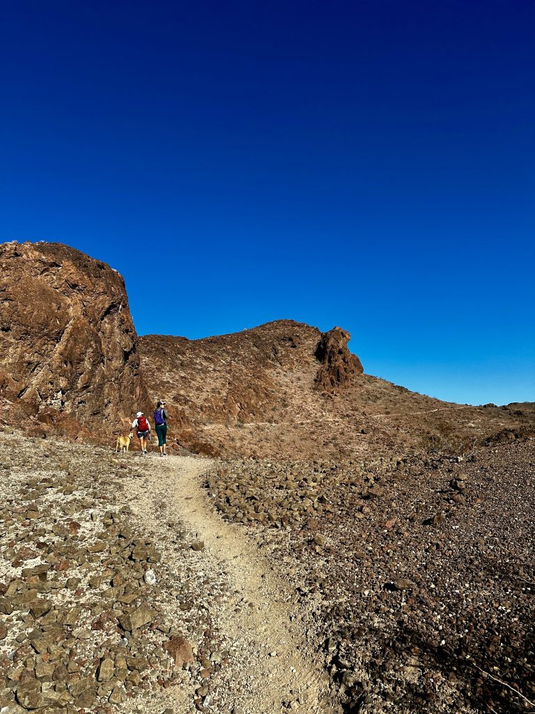
Cliff base trail is exactly that. The trail traverses the base of Lizard Peak from the saddle between the two high points to the junction of the blue trail and the other side of the Lizard Peak Trail. There is an amazing cave along the way and incredible views. Click the link to see our hike. Because we seldom hike one trail in SARA park it is difficult to be specific pertaining to mileages. We often hike off trail and connect many trails together, most we have no idea the names of.
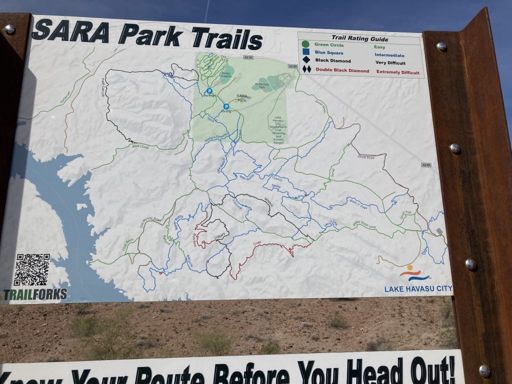
Signage at SARA park is improving. Each year we have been here, we notice more informative signs and better marked trails. However, trails in SARA park have numbers. I can see these numbers on many of my apps. But, I have not found a complete guide listing trail numbers with corresponding names, distances, elevation gains, or destinations. This is common information which we use to plan hikes that meet our ability. Here, we wing it!
Fortunately, we have learned about many of the destinations from our hiking group, in addition to following others on a few local Facebook groups. Because there are so many hiking, biking, and animal trails interwoven it is unlikely to hike the same exact route. Thus our milage is specific to that particulars day’s adventures. Early on this was definitely a hindrance to our exploring, but with more experience and a couple of apps that track our steps, this has become a positive experience. It’s incredible finding the “gems” within this park, often with no one else in sight.
Pilots Rock
Pilot rock is an incredible feature along Lake Havasu. The is just under seven miles roundtrip with about 700′ of elevation gain. The hike to this location is a combination of ups and downs through washes and along ridges. Like most hikes in the park distance is relative to the trails you walk, there are many variations. The trail we hiked began on Trash Can trail to Watershed Loop, then to Pilot Rock. Additional, trail options are Sonny’s Trail, or linking the Watershed Loop to the Recycle trail.
We visited Pilot rock last winter, during that time the Lake Havasu Lighthouse Club was renovating the Lighthouse which normally stands guard in this location. Portland Head Light is lighthouse we were hiking to see! Most of you know, we are from Maine and to see our State represented here, protecting boaters in Lake Havasu is Awesome! A great reason for us to hike back to this location again.
The Mines
The mines we found unexpectedly. There were several mines within a couple miles, some were horizontal into the hills and some were vertical shafts into the ground. We found remnants of mining debris throughout the desert in this area. I believe we used a combination of trails similar to the ones we used to hike to Pilot’s Rock, but because of the enormous amount of offshoots I really have no idea! Our total mileage for this hike was over ten miles.
My best advice is to follow the watershed loop trail to the recycle trail then keep your eyes open. We did go off trail and climb to many of the high points. At one point we were standing across the river from Havasu Palms, which is located in California. A long hike through many different types of terrain, including an incredible canyon.
The Arch
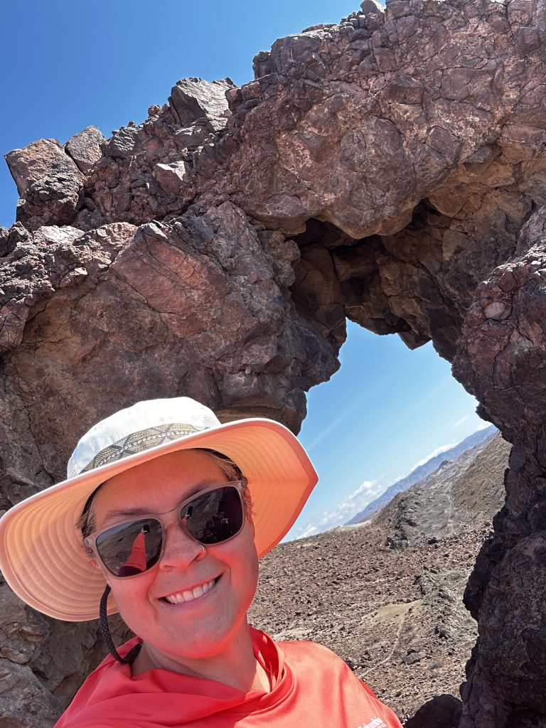
The arch is visible from many areas in SARA park. It is located about two miles from the first parking area. Several trails provide access. We began in the Yellow wash trail and proceeded up the Lizard Peak trail to the top of the mountain. After a water break we hiked across the Blue trail to the saddle near the Crack trail. From there we descended into the wash at the end of SARA Crack.
We then took the first trail on our left and climbed out of the wash, within a short time we could see the arch. The offshoot trail to the arch is easy to follow and pretty short. A few pictures and a snack and it was time for us to move on. As we had no idea where we were going we took the most obvious trail which led us around a small hill, which then led to an enormous wash.
We recognized this area as part of the watershed loop trail, which we followed back to the Red trail and eventually the Yellow to our car. The hike was wonderful and exposed us to some areas of the park we had never seen. Our distance was just under five miles and about 1300′ elevation gain. I’m positive there is a shorter trail, but we were in search of a climbing adventure. It was a beautiful view from the arch.
Safety at SARA Park
Safety at SARA park is a bit more difficult than other areas we have hiked. There are maps available, however they are not complete. It is difficult to judge distances and amount of elevation gain, because with the exception of Lizard Peak most of the terrain is constant ups and downs. Washes are the primary trails through the park, with several trails crossing ridges and connecting washes together.
We visit SARA park in the winter months, which is normally cooler weather. However, it is important to be aware of temperatures and pick cooler hiking times. Also because of the amount of washes be aware of rain, which can create flash floods. Hike with a friend and make sure someone knows where you are. Bring plenty of water, one quart is recommended for every two hours of hiking. Protect yourself from the sun with appropriate clothing and sun screen. Boots with rigid soles help protect your feet from sharp rocks and thorns and always be aware of slithering friends.
We carry our backpacks on every hike. Between the two packs we have a med kit, water filtration system, matches, lighter, knife, emergency blanket, short length of rope, extra water, and food. In addition, to our normal gear we vary our clothing based on weather conditions. Always several layers, even if it is a warm day. The desert is a cold place at night, and if we had an injury or became disoriented and had to spend the night, extra clothing could be a life saver. Be Safe and Enjoy! Live Simple Live Happy