The Columbia River Gorge is an amazing place, located between the States of Oregon and Washington. It is approximately eighty miles long and up to four thousand feet deep. Created from a combination of ancient volcanic activity, as well as unbelievable flooding at the end of the last glacial period. We hiked mountains and waterfalls, and witnessed the results of these amazing processes firsthand. There are museums and visitors centers, which provide a wealth of information about the area.
Although our visit lasted only a week, we were able to enjoy a variety of experiences. There is so much more to see and do, we hope to visit again. This was our trip.
Oregon
Oregon “The Beaver State” was admitted to the union in 1859 and became America’s 33rd. state. It is the ninth largest state in the union and supports a highly diverse eco system. From the highest elevation, of the snow covered 11247′ ancient volcano, Mt.Hood to the arid eastern plains. The eastern low lands are part of the immense Great Basin. Which is a unique geographic feature, where all the water that flows into it does not flow to the ocean, instead it gets absorbed or evaporates. Additionally, there are coastal, wetlands, desert, and forest eco-systems.
Major river’s dictate much of the topography and borders of the State of Oregon. The Columbia River and Gorge to the north, separates it from the State of Washington. The Snake River is to the East separating it from Idaho. The Klamath River to the Southwest does not form the border with California, however is a major contributor to Oregon’s growth and development. A range of ancient volcanos majestically cuts across the State, proudly showing off their once mighty power, with an impressive display of almost year round snow covered tops. Then there’s Crater Lake, the deepest lake in the US at 1943′.
Oregon’s importance in the Union was as pivotal at its incorporation, as it is today. The location of the infamous Lewis & Clark expedition’s winter settlement. Previously, home to many European and Spanish traders, fishermen, and trappers as far back as the mid fifteen hundreds. Evidence has been found of inhabitants living across the State, dating back 15,000 years ago. Today, Oregon is the largest lumber producer in the lower forty-eight, as well as a major economic force in the emerging technology market.
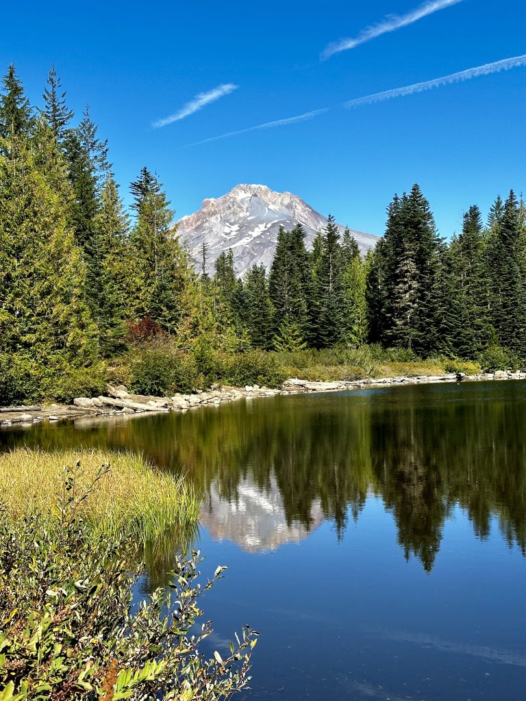
Mt. Hood
Mt. Hood is 11,249′ and the highest mountain in Oregon. It is described in wikipedia as an active volcano and one of many volcanoes within the State of Oregon that is part of the ring of fire. The ring of fire, encircles the Pacific Ocean. It is the location of substantial tectonic activity, and home to many of the Earth’s active volcanoes. Mt. Hood has had several eruptions in the last 1800 years, including a minor eruption in 1907, and scientists think it is the most likely Oregon volcano to erupt again. Although slim, there is a 3-7% chance of eruption in the next thirty years.
The volcano is an irresistible playground for climbers, hikers, and skiers. More than a 1000 miles of trail, are located throughout the Mt. Hood National Forest. An extremely popular mountain with as many as 10,000 people attempting to climb to the summit annually. A place where a hiker of reasonable skill and condition can hike to an elevation of 8510′ along the Cooper Spur Trail. Beyond that elevation it is technical climbing with ropes and gear required. The peak also has year round snow and several named glaciers. There are multiple ski areas located on the mountain and one which operates year round.
A climb attempt was not in the plan for this trip, however we learned about the area, and resources. Hopefully, we can come back at some point and climb to the high point of Cooper Spur Trail. Beyond that, we’ll leave to the experts! For more information about other volcanoes we visited see our Volcanoes blog.
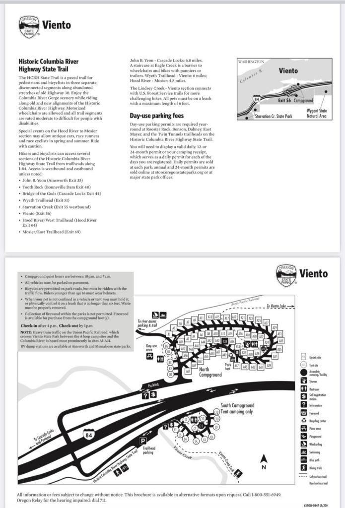
Viento State Park
Just outside of Hood River, Oregon we chose Viento State Park. Viento State Park is one of many campgrounds along Interstate 84 Southeast of Portland, Oregon along the Columbia River Gorge. There are many pros to this park. It has wonderful river access, just a short distance from our RV spot. Amazing tree coverage, but still enough of a sky view for our satellite to work. Access to hiking and biking trails without driving anywhere. As well as being on the major highway just a few miles from grocery stores, restaurants, and the amazing city of Hood River.
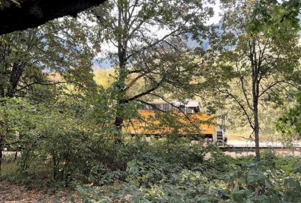
But, there is also one pesky problem with this campground. The campground is nestled between Interstate 84, the Columbia River, and two exceptionally busy lines of the Pacific Railway. Our site was about fifty feet from the tracks, we could feel the trains, before we could hear them. The RV would start to slightly sway and then the low unmistakeable roar of the steel wheels rolling across the steel tracks, getting closer and closer.
At all hours of the day or night the train’s conductors would blow their whistle, as they got closer. Because the tracks pass directly through the State Park with no fences or crossing gates, I learned it is required. I especially, appreciated how on several occasions, I could imagine the conductor was experiencing a bad night or didn’t quite have enough morning coffee. The emphasis and voracity applied to the whistle seemed to resonate their frustrations and pierce the darkness, awakening even the heavy sleepers like myself.
I love trains, and we knew the tracks were there before booking the site. Jess brought several pairs of ear plugs and I watched in amazement as double decker trains whizzed by in both directions.
Lake Missoula
This area of the Columbia River Gorge was blanketed with 5000′ of basalt rock, over seventeen million years ago. This highly volcanic area had more than 300 individual lava flows. Then 15,000 years ago, during the last ice age. A glacier flowed into Northern Idaho. Its debris caused a channel of the Columbia River to become dammed. Behind this dam the enormous 3000 square mile Lake Missoula formed. This huge lake broke through the earthen debris dam over a hundred times throughout a period of 2000 years. Thus, shaping the gorge we see today.
The largest flood was estimated to be 1000′ deep, traveling at sixty miles per hour and carrying more than ten times the combined flow of all of today’s rivers. That statistic is baffling to me. I cannot even imagine the enormity and destruction it caused, or in this case the amazing, beautiful gorge we’re hiking in today! Many of the ancient layers of lava flows are easily seen in the steep walls of the gorge, especially near Multnomah falls.
Waterfall Corridor
Often referred to as the waterfall corridor, there are over ninety major waterfalls, just on the Oregon side of the Columbia river. If waterfalls are your happy place, this is a must visit area. Many of the largest and most impressive falls can be accessed easily from paved paths with little to no walking. Following I-84 there are several pull-offs, which have parking areas, picnic and restroom facilities, as well as hiking trails.
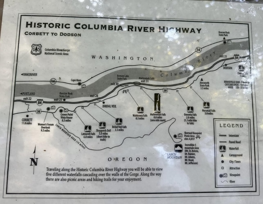
Wahkeena Falls
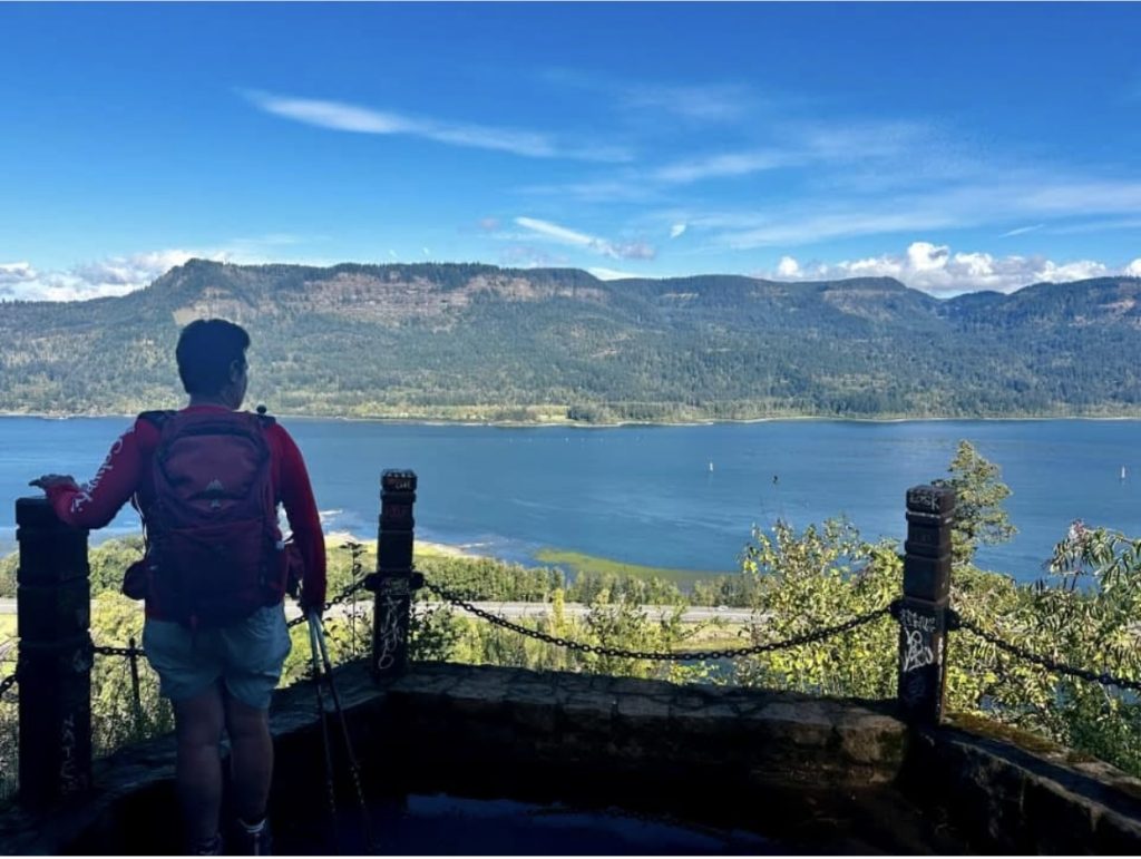
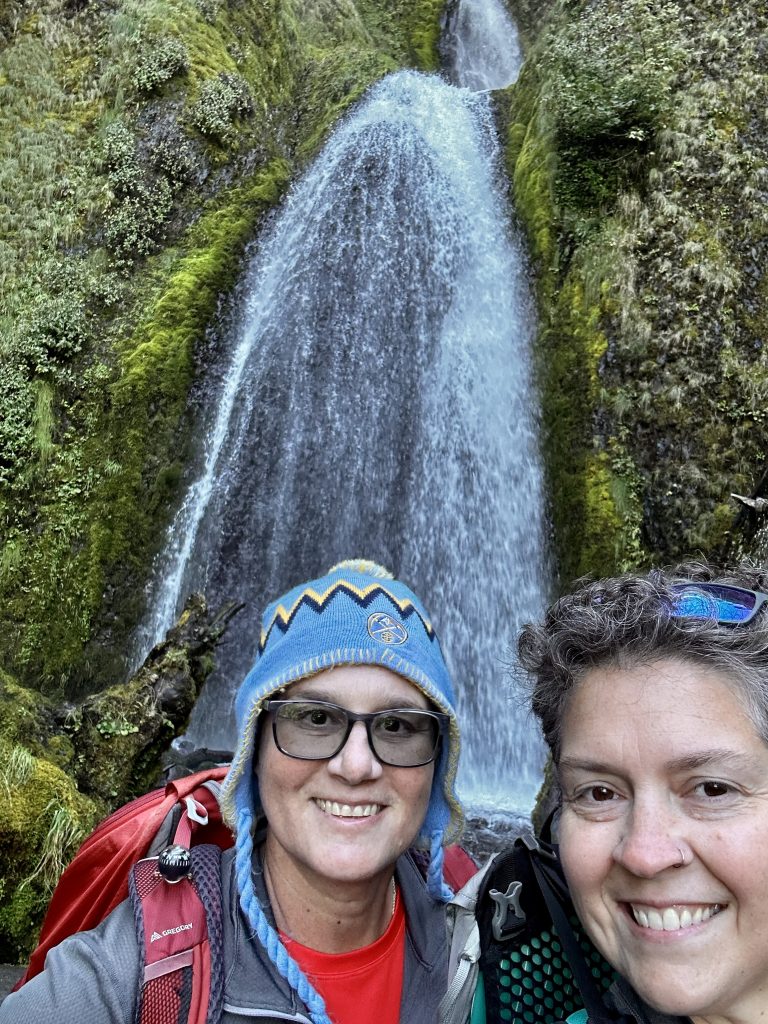
We chose a loop hike beginning at the Wahkeena waterfall. This loop links together several trails including the Larch Mountain Trail and a short road walk to complete the circuit to Multnomah falls and visitor center. This route is not for the faint of heart, especially in this direction. The trail is well built, has good footing and a ridiculous amount of switchbacks. But, it still gains 1400′ of elevation in the first 2.2 miles. The entire loop is 5.25 miles long, only picking up an additional 150′ of elevation, over the entire rest of the hike.
The thing about loving waterfalls is the hikes usually involve a lot of climbing, both up and down. If there is no drop-off there is no waterfall. Being able to see a couple of these massive waterfalls from ground level is quite unusual. Our hike provided us views of several major waterfalls, and many minor no name run-off streams. The trail was a lush, rain forest like habitat, at the base of the falls, and a more open coniferous forest near the top of the ridge. An overall beautiful hike and well worth the effort. All of the waterfalls pictured below we saw as we hiked this loop.
Wahkeena Falls is 242′ tall
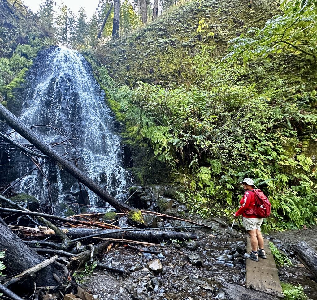
Fairy Falls is a 20′ waterfall.
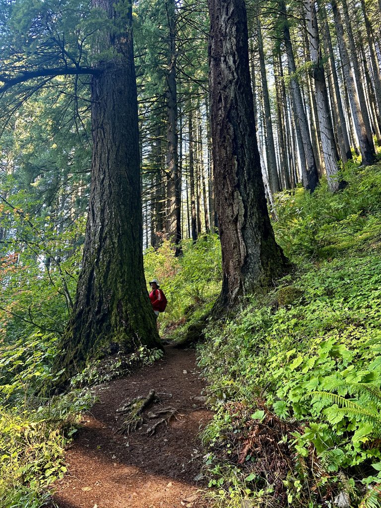
Many species of Fir and Hemlock but, primarily Douglas-Fir at this elevation.
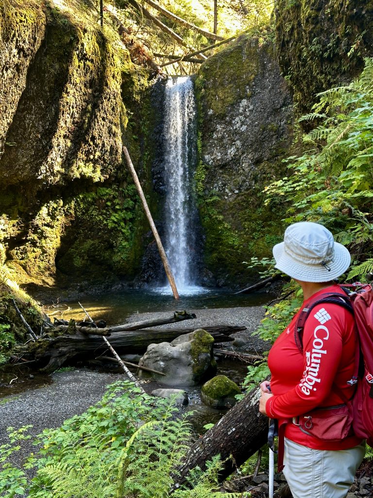
Wiesndanger Falls 50′
Multnomah Falls
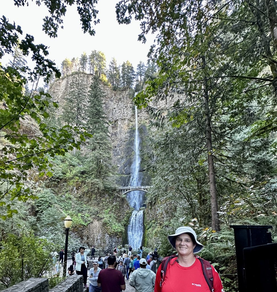
Multnomah Falls is the second tallest year round waterfall in the country at 620′. The upper falls is 542′ and the lower falls is 69′, with an additional 9′ drop between them. Over two million people visit the falls annually. The visitor center is conveniently located near the falls, and provides restroom facilities. We visited the falls in October, when no permit is necessary, however permits and day-use passes are required between the months of May thru September. and are available on recreation.gov.
Multnomah Falls is the best place to see the distinctive layers of lava flows, which in conjunction with the flooding from Lake Missoula created this gorge. Colonade and Entablature lava both form when lava cools slowly, causing it to shrink and make cracks. Colonade lava typically forms 5 to 6 sided columns. Entablature is a thinner layer of lava, above the layer of Colonade. It is described as chaotic and highly fractured, with the appearance of a rough texture. Also visible is Pillow Lava. This lava forms when lava flows into a water source. The quickly cooling lava often forms what looks like pillows.
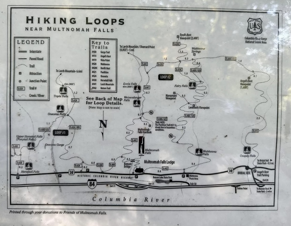
There are many trails and loop options. Remember the ridge is about 1400′-1500′ of elevation gain in this area, meaning any loop you complete will definitely have significant climbing. We found the trails to be well marked and easy to follow with good footing. There were many water crossings, most all on bridges. It had rained recently and the streams were full and the trail a bit slick in a few areas. Consult trail apps or rangers for more detailed information.
Wind Surfing & Kite Boarding
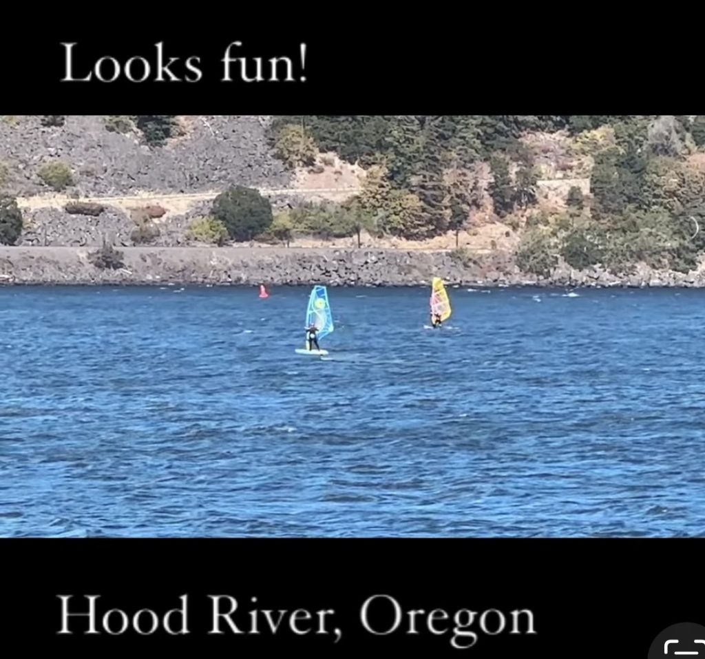
I did not even know what to call it. Yes, I had to look it up. Is it wind surfing? Kite boarding? What are all the different types of equipment? Who knew this was a thing? Yes, I’m sure if you’re from the west coast you have seen this your entire life, and maybe even have your own equipment. Being from Maine this is not a common sight.
After some research, I learned Hood River is known as the “windsurfing capital of the Uniter States”. Because of the steady winds and warm water temperatures, a bustling community has developed along the water front providing amazing access to open space and launch areas. There are restaurants and parks, with plenty of parking and free access to the river. Lot’s of space to put your equipment together, have a picnic or just enjoy watching.
We had lunch at a local brewery just a few hundred yards from a primary launch location, near the downtown. After lunch we sat under a tree on a bench with front row seats to the entertainment on the river. We watched men and women, young and old, ride the wind on a variety of boards, sails, and kites. The speeds and distances some were traveling was amazing. Some flew through the air and gracefully landed several feet from where they had taken off, others had some dramatic crashes. All looked like they were having a blast! Maybe someday we’ll give it a try.
Fruit Loop Trail
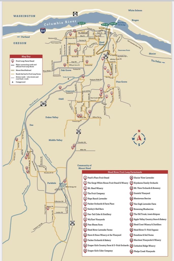
The Fruit Loop Trail is a “trail” established to help promote local farms and businesses along the route. We found this gem when we stopped at the local visitors center. As is often the case, even though we attempt to research interesting activities in areas we visit ahead of time, we had not heard of this. The trail is actually a driving route through the beautiful landscapes of the Hood River Valley. It has stops at breweries, farms, wineries, orchards, bakeries, and even a store called the Old Trunk, one of my favorite stops.
We enjoyed fields of lavender, purchased jars of jam, and walked in orchards bursting with trees full of apples, and pears. The smells delighted our senses. All within the views of volcanoes in several different directions. We fed goats, indulged in some delectable pastries and even found some dairy-free ice cream. The ‘trail” is a 35- mile loop. Providing a glimpse into life here in this fertile river valley, both now and throughout its history.
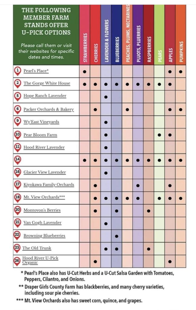
I would highly recommend taking the time to visit at least of the few farms and business. We visited in the fall, which ment some harvests were completed and some were just beginning. Not all of the businesses were open, however, their website provides great up to date information.
Gorge Discovery Center
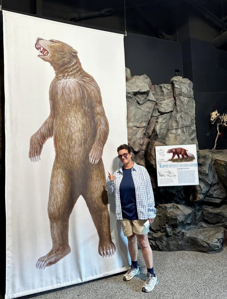
The Gorge Discovery Center is located in Dalles, OR. The museum sits on the Oregon side of the Columbia River, providing wonderful views into the gorge. A small fee is charged to enter. The museum is amazing. There are a variety of exhibits from geology to the history of the settlers throughout the ages. Definitely something for everyone.
Above, I am pictured standing in front of a Giant Short Faced Bear. I learned, that the animals were larger during this period of time, dating back over 1.8 million years ago. Scientists believe, it was because of mild temperatures and the excess availability of vegetation and prey. Eventually, the bears went extinct about 11000 years ago, probably because of a cooling planet and decrease in food.
As of the publication of this article, I learned the Discovery Center is currently closed because of recent wildfire activity in the area. The buildings were saved, however the grounds and outside exhibits are still being assessed. This location, is to the east of Hood River, and is where the topography changes from lush waterfalls to a drier arid climate, making it vulnerable to wildfires. Check their website for updates.
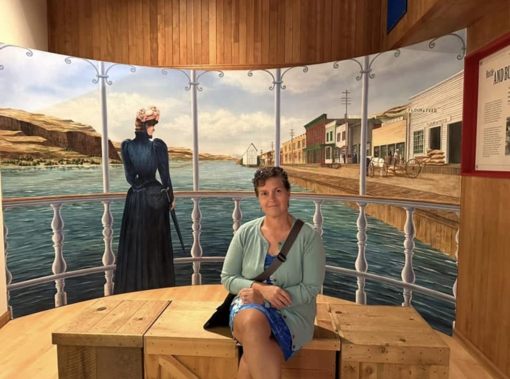
Caught Jess taking a break in one of the many exhibits, depicting life alongside the banks of the Columbia River.
Tom, Dick & Harry
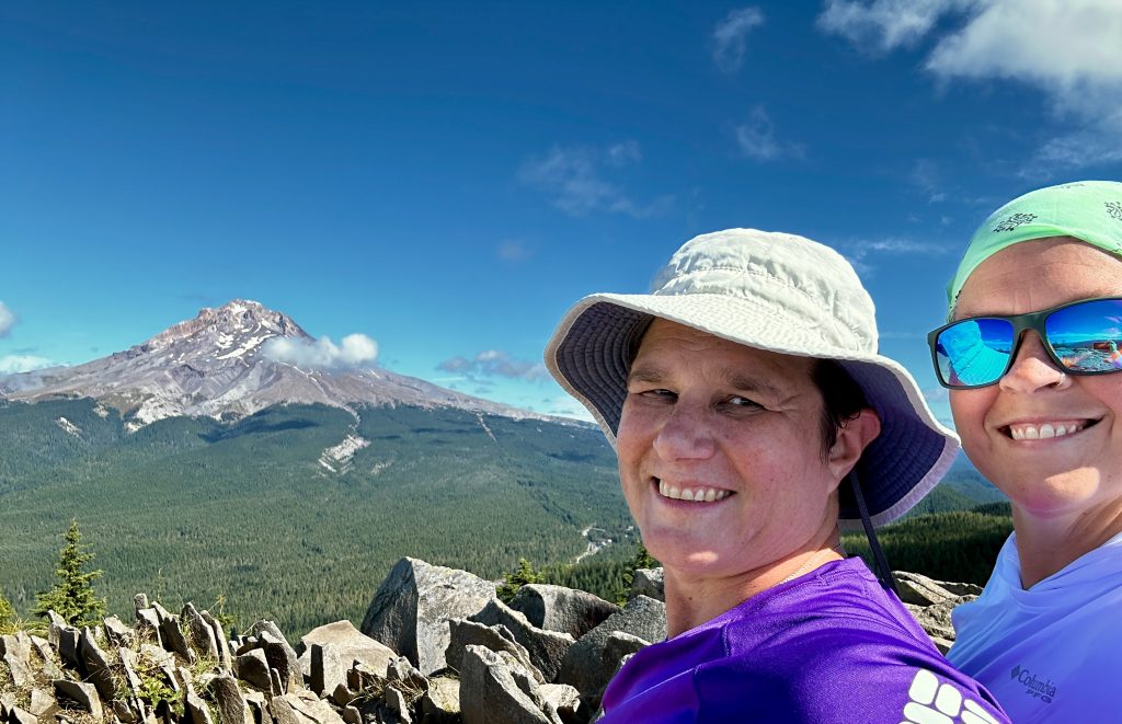
I picked this hike because the name intrigued me. I read, that it overlooked Mount Hood, and potentially had views of Mount Adams, Mount Rainier, Mount St. Helens and Mount Jefferson, all volcanoes. That would be quite impressive, for an eight mile hike with only 1700′ of elevation gain. The trail begins at a new parking area near Government Camp, Oregon, which is about an hour from Viento State Park (our campground).
Things I didn’t realize about the hike were the incredible views and how much the trail would feel like “home”. By home, I am referring to all of our years hiking in the NH White Mountains. The trees and streams, combined with the granite, roots, and rocks felt familiar. Jess and I were joking about how seldom we encounter roots, or even rocks in the trails when hiking in the west. At one section of the trail we were climbing across an older rock fall, which has since been re-vegetated. As I hiked and looked out at the ridges across the valley, I thought how many places in the White Mountains, would look and feel just like this.
Pictured above is the aptly named Mirror Lake, the destination of most people hiking on the trail. If you have the time and ability, I’d definitely recommend continuing on to the summit. Really it’s three summits, hence the name. I believe most people turn around at the first summit. We continued on and eventually lost the trail, however even as clouds moved in we saw views of three of the five volcanoes. An amazing day and wonderful hike.
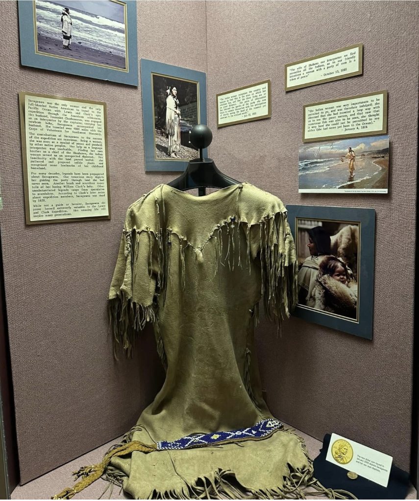
Lewis & Clark
I was familiar with the names from our brief readings in history class, but had no idea of the massive undertaking of their journey. Including the enormous amount of work, which needed to be completed for the expedition to be successful and Sacagawea’s pivotal role as an interpreter and guide. The Columbia River Gorge was the final challenge before they reached the Pacific Ocean.
Our full-time RV journey, provided us the opportunity to visit several locations along Lewis & Clarks route. We previously visited the Dignity Statue, which is a fifty-foot statue overlooking the Missouri River. The statue of a native woman honors the cultures of the Lakota and Dakota peoples. The statue is near Chamberlain, South Dakota, at a rest area with plenty of parking and amazing river views. This location also has a museum dedicated to the Lewis and Clark Expedition. and was one of their prominent camping spots.
We also visited Pompeys Pillar National Monument located in Pompeys Pillar, Montana, along the banks of the Yellowstone River. Another camping location of the expedition and incredible museum. Famous for the sandstone outcrop, where Clark etched his name.
Fort Clatsop
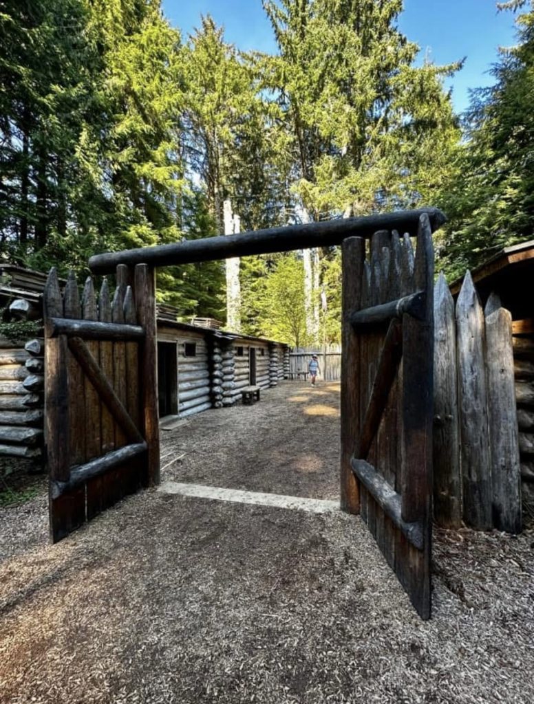
Above is a replica of Fort Clatsop, the winter home of the Lewis & Clark Expedition, after reaching their goal of a Northern route to the Pacific Ocean. The Lewis and Clark National Historical Park at Fort Clatsop, in Astoria, Oregon is the primary Lewis and Clark Museum. Located near the mouth of the Columbia River Gorge.
The replica is amazing and is complete with tables, chairs, and sleeping quarters for officers and enlisted men. It provides a look into the daily life and challenges of the group. I read how accurate the maps were, which Clark created throughout the journey, all without today’s tools and technologies. This was all in addition to traveling, hunting, portaging supplies and negotiating safe passage through native lands.
The museum had a brief movie presentation, amazing exhibits and hiking trails. We spent several hours exploring. I especially loved the big trees on the property!
We loved our time visiting the Columbia River Gorge. There is so much more to do. I think we could spend months, just in this area. Hopefully, we will visit again. Live Simple Live Happy