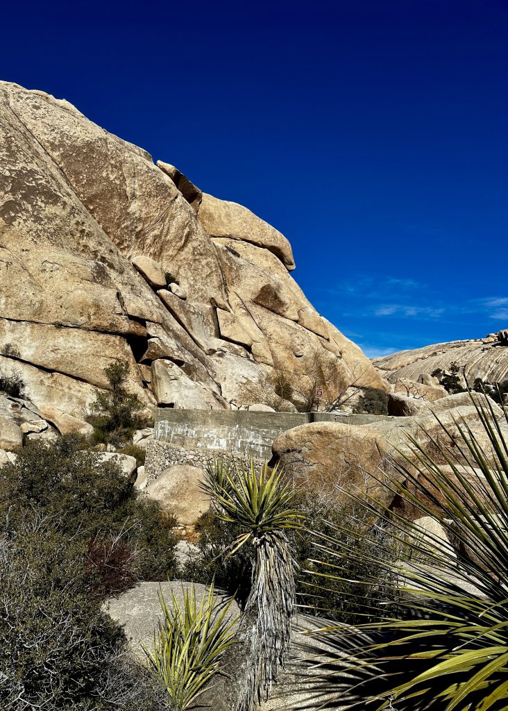
Joshua Tree National Park is located in Southwestern California. It encompasses parts of the Mojave desert, as well as the Colorado desert. Joshua Tree is a feast for the eyes. Out of this world rock formations upstaged only by the diverse and plentiful flora. The park is a rock climbers paradise drawing all level climbers from around the world. Surrounded by and including several mountain ranges and expansive basin areas, elevations in the park vary from 536′ to 5813′. Thus, providing many vantage points to explore the amazing features of this over 800,000 acre National Park.
The park became a National Monument in 1936, then in 1994 Congress expanded the park and created Joshua Tree National Park. The park is primarily a wilderness area. Rugged mountains, deep basins, with a variety of plant and animal life, all living in an arid climate with temperatures ranging from about 35 degrees F to over 100 degrees F in the summer.
Many types of trees and plants grow in Joshua Tree National Park, including Joshua Trees, ocotillos, cholla cactus, smoke trees, palo verdes, creosote bushes, Mojave yuccas, California junipers, pinion pines, and even native fan palms. Additionally a vast amount of wildflowers and various other cacti. With just a little rain the desert comes alive.

Visitors Centers

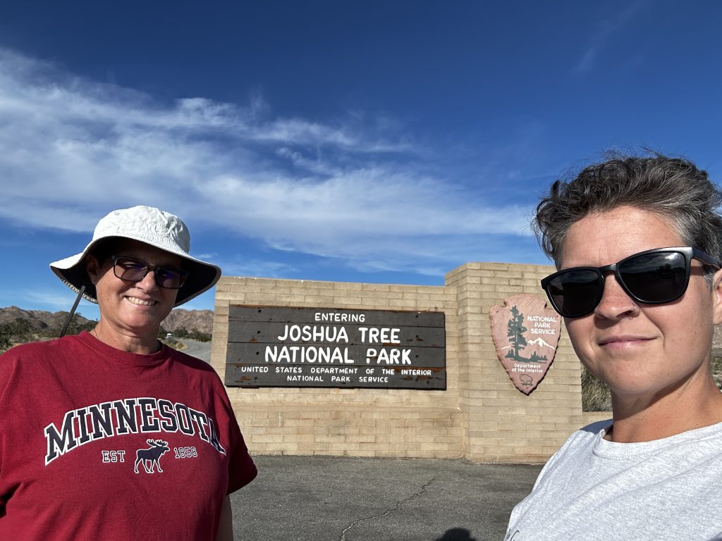
We began our journey at the visitors center, actually pictured above was our second visitors center of the day. Because we decided to visit the area for a month we chose a nice RV spot in Desert Center near the south entrance to the park. There is the small informative Cottonwood Visitor Center complete with restroom facilities, at the southern entrance to the park.
Above is the Oasis Visitor Center located in the city of Twenty-Nine Palms at the Northeast entrance to the park. It is a beautifully constructed large visitors center with interpretive displays and many artifacts. We spent an hour exploring and learning the history of the area, picked up a map and used their wonderful facilities before embarking on our journey.
At the Joshua Tree entrance on the western side of the park, there is another visitor center. As well as the Black Rock Nature Center and gift shop located on Black Rock Canyon road near the Black Rock Campground. As this area was over a hundred miles round trip from our RV we only visited the area once and did not have time for shopping only hiking!
Joshua Trees
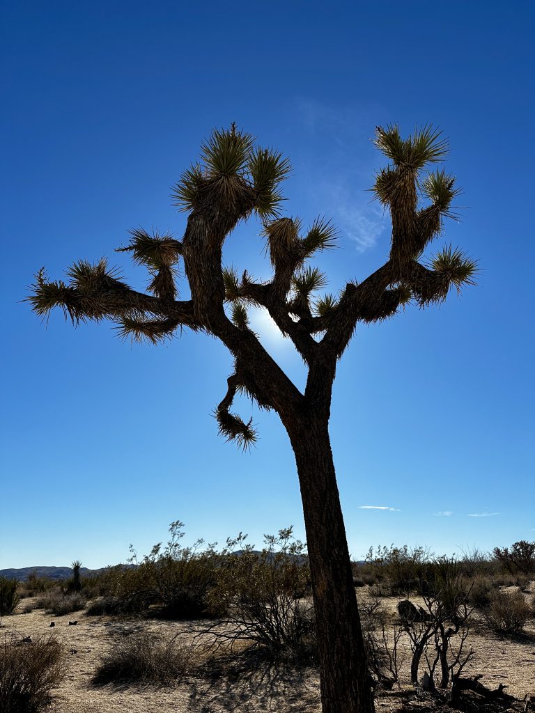
Joshua trees, the namesake of the park, allegedly got their name from the Mormons. Early Mormon travelers thought the trees shape looked like Joshua raising his hands into the sky and leading them, like in the bible. The trees are actually not a tree, they are a yucca and members of the agave family. The trees grow an inch per year, reaching heights of forty feet, and live for 150 years. They have a narrow range of habitat between 2500′-4000′ of elevation.
Similar to saguaros the Joshua trees are very important to other desert dwellers, providing habitat and shade for smaller animals and birds. Many animals additionally use them for food. Humans have also found many uses for Joshua trees, including using their flower buds for food and leaves for baskets and sandals.
Unfortunately, rising temperatures could pose a danger to Joshua Trees which require a cold spell to trigger dormancy, but not too cold which can damage the plant. A period of dormancy allows the plant to store energy and prepare for spring flowers and propagation. Without a sustained cold the trees may lose this ability.
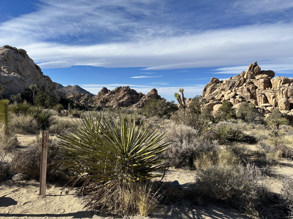
Fortynine Palms Oasis Trail
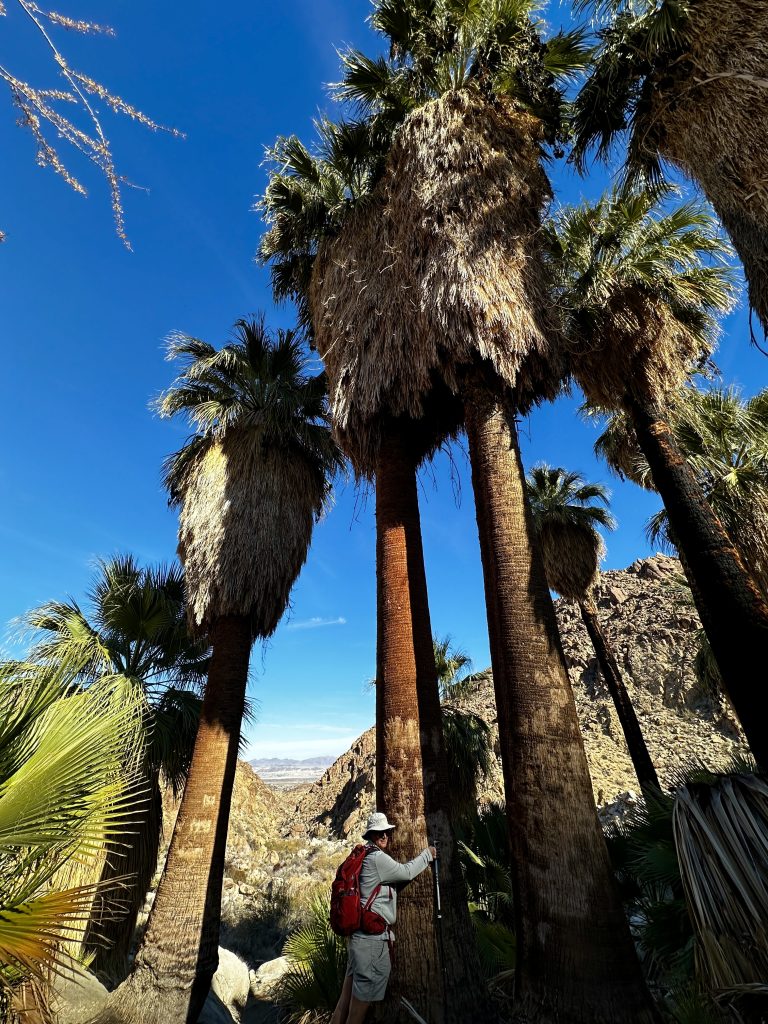
Fortynine Palms Oasis trail is located in the northern section of the park and was one of our first hikes. The trail is just a couple of miles from the Oasis Visitor center. Follow the 3.2 mile long round trip trail through washes and ridges to an incredible canyon. The hike gains about 600′ of elevation with only a couple of steep sections. It’s mostly just a wonderful walk through beautiful rolling terrain.
Beware there is a park sign at the beginning of the hike warning that death can occur on this trail. We read the sign closely and re-checked the distances, elevation gain, and trail description. Admittedly, we were less experienced hikers in a desert climate and were trying to figure out if we had missed something we should know about the trail. We were well prepared with extra water, proper clothing and shoes, snacks, trekking poles, and safety gear, and began the hike.
The terrain was not that difficult, but it was in full sun. Something we had already learned about desert hiking is that air temperature is just one part of understanding the heat in the desert. The mostly sandy soils radiate heat back up from the ground, think about a walk on the beach and how the hot sand feels. Now imagine this coupled with air temperature, without enough water a perspiring hiker could quickly become at risk for heat exhaustion or heat stroke.
The hike was wonderful, without any issues, however we did offer some of our extra water to a couple of ill prepared hikers.
Cholla Garden
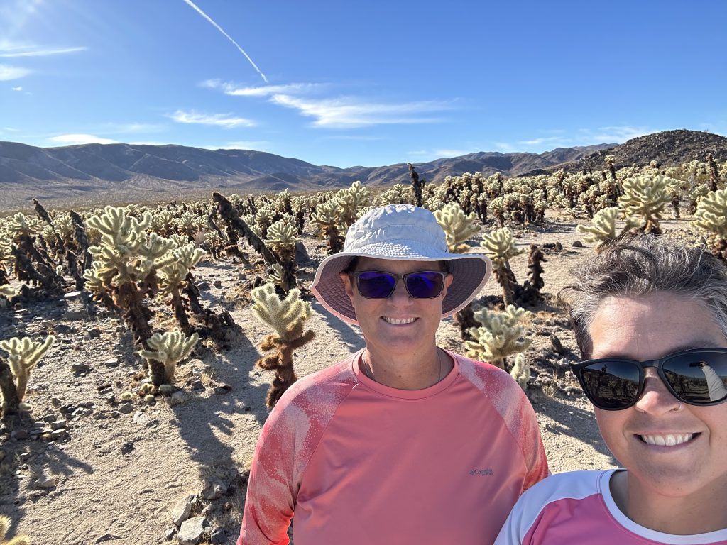
Chollas come in many varieties and are common in the desert southwest. They are beautiful and not to be messed with, their thorns are indiscriminate and attach to anyone or anything. They have large barbed thorns which easily detach. Some varieties grow as tall as nine feet with a five foot diameter. Chollas are plentiful in many areas and provide an important food source for many desert dwellers.
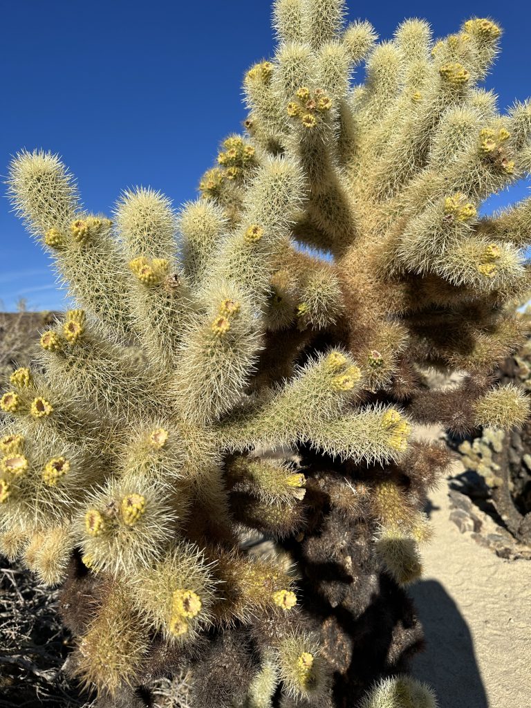
Our first encounter with a “jumping” cholla was in Eldorado Canyon, Nevada on an off-road vehicle ride. The tour was guided and we were warned about the chollas propensity to “jump”. However, when we stopped for lunch several members in our group were exploring too close to a cholla cacti. When they were “attacked”. Our guide made a quick joke about the victims usually being men and then proceeded to remove the thorns from our friend. We observe them from a safe distance!
The Cholla cactus garden is located just below Wilson Canyon on the Pinto Basin Road. We passed by it when we traveled from the south entrance to the northern areas of the park. We stopped several times and were wowed each time by the colors and vast amount of chollas.
Arch Rock Nature Trail
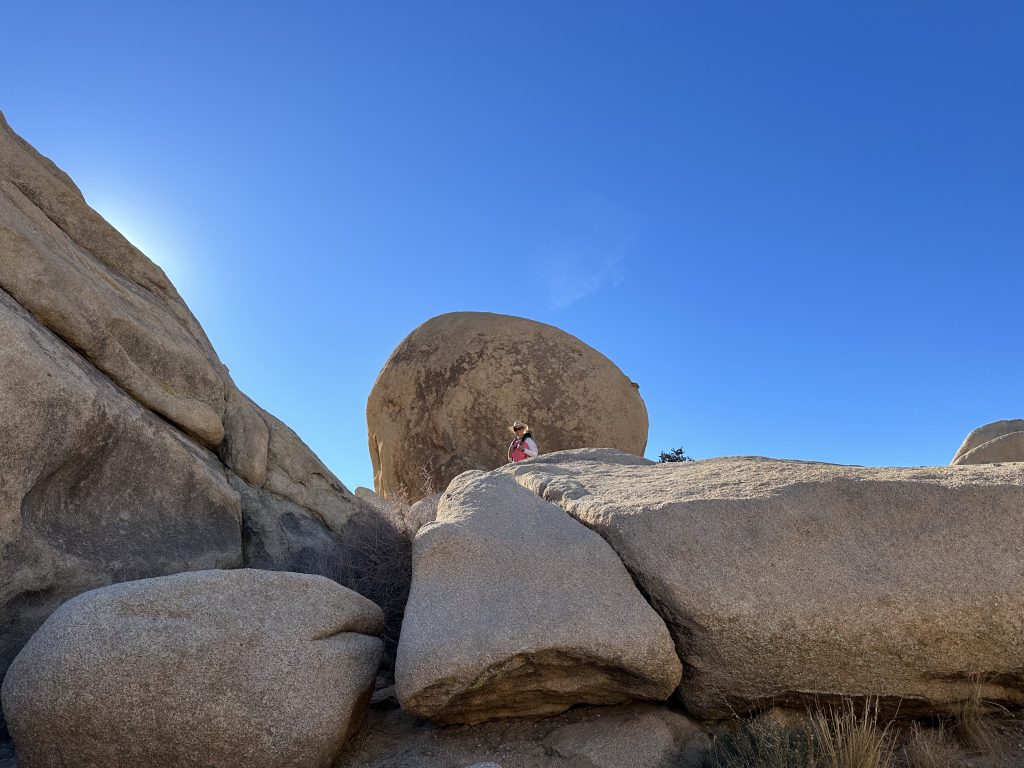
Arch Rock Trail begins from the Twin Tanks parking area along the Pinto Basin Road. The trail is 1.2 miles long with less than 100′ of elevation gain. Most of the walk is well marked with good footing, in sandy soils or on solid rock. There is no shade on this hike, so if it is a hot day be prepared with plenty of water despite the short distance. If you’re camping at White Tank Campground it’s a short walk to the trail. I would plan at least an hour to walk around and explore the granite formations. It is busy so if you want a picture be prepared to wait in line.
Heart Rock
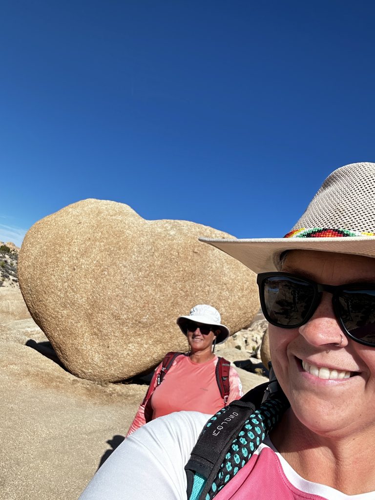
Naturally formed granite rock with an amazing shape. There is no official trail to heart rock, however, there were people wandering around everywhere and it wasn’t difficult to find. We veered left off the main trail and climbed through a wash. Once we were atop a small ridge we could see many interesting shaped boulders, as we continued walking we spotted the infamous Heart Rock. Because there were so many people we patiently waited our turn and quickly snapped our picture.
As most of you know, I have a Love/Hate relationship with National Parks. I love them and appreciate everything about them, they are treasures and if I am lucky I will be able to visit many more of them. I hate how many other people have this same opinion. They are so crowded, especially a trail like this which is a short walk. We explored many other unique formations past heart rock and had the place to ourselves. It was wonderful to see mother natures “artwork”.
Arch Rock
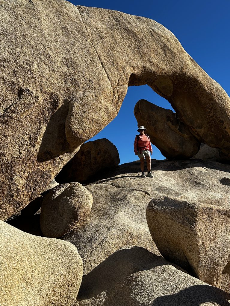
Arch rock is exactly that! Located at the end of the main trail. A small rock scramble is required to get to where I am standing. There was a long line so we decided to find heart rock first. When we returned we were able to climb up after helping a couple people trying to get back down. The up is always the easy part, climbing down is more difficult and scary to some.
Hidden Valley
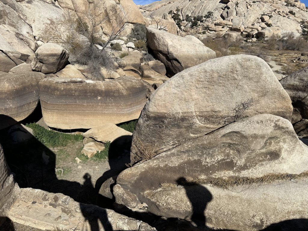
Hidden Valley is one of my favorite spots in the park. From the parking area the trail navigates several large boulders. When you clear the boulders an enormous valley, surrounded by irregular boulder piles and high tower rock formations surround you. The vegetation is diverse and plentiful, within the valley. There is no official trail, it is more of a wander at will type of place, the same as several areas within the park. We logged one and a half miles exploring, reading information boards, and watching rock climbers.
Hidden Valley is an infamous hiding spot for cattle rustlers back in the day. Because of the boulders, high towers and the difficulty of finding the entrance it was a perfect location to stash and re-brand stolen cattle.
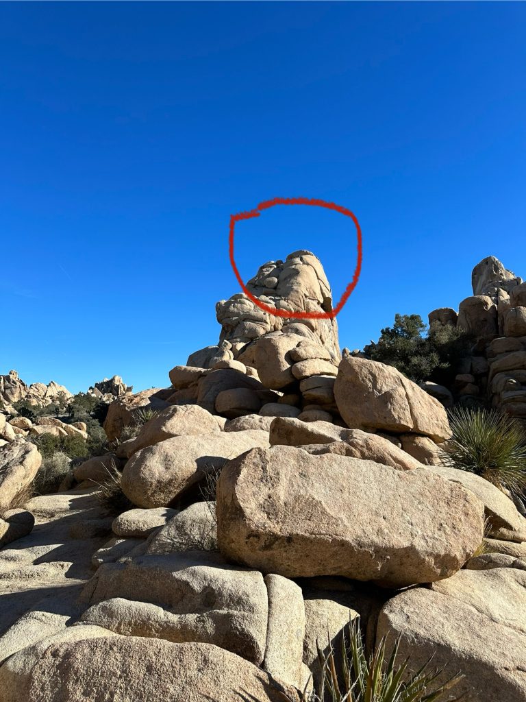
Circled in the picture above is a group of climbers topping out. We saw several groups climbing a variety of routes. Hidden valley is one of the more popular climbing areas in the park. In addition, Quail Springs, Wonderland of Rocks, Indian Cove, Hall of Horrors, and Jumbo Rocks are just a few of the amazing climbing areas. Bouldering and Traditional climbing are all plentiful within the park, as well as limited Sport climbing. Famous for crack and steep faced wall climbing, all close to roads and camping areas.
Key’s Ranch
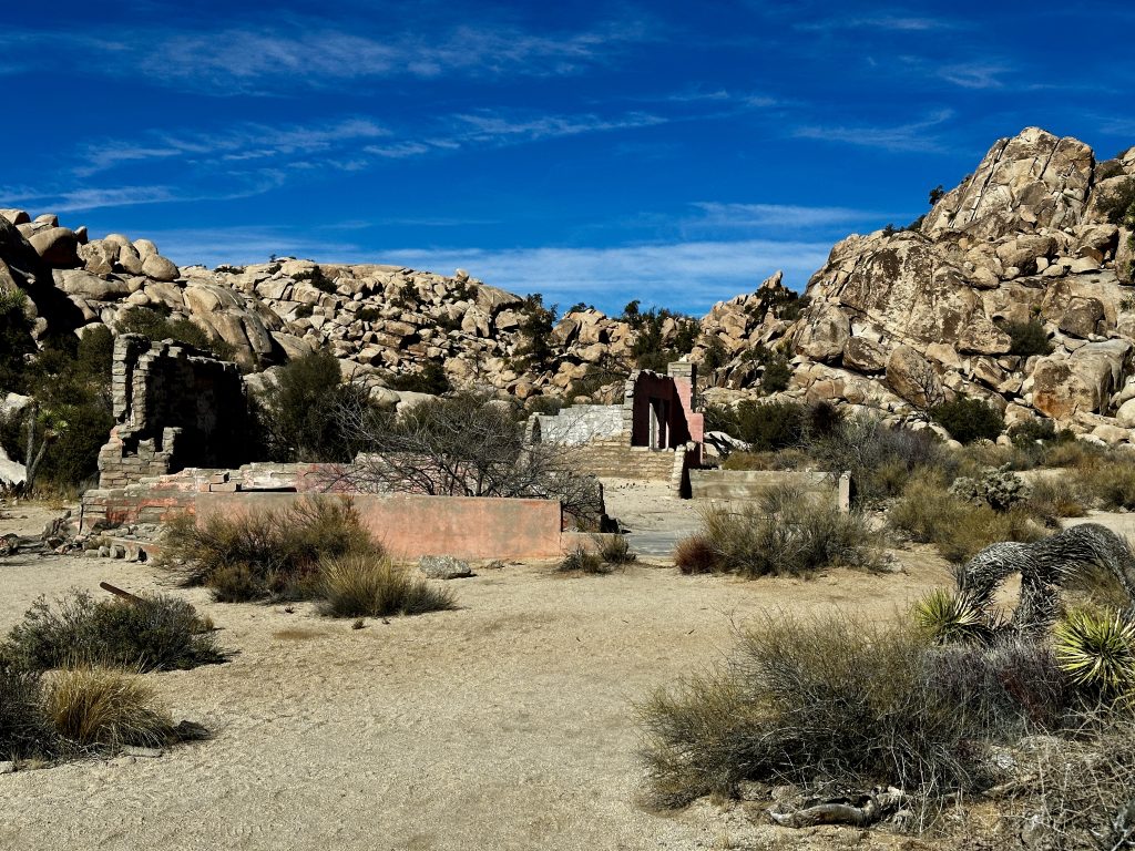
The remnants of Key’s Ranch. We explored the Keys Ranch Trail, Barker Dam Nature Trail, Echo T, and Wall Street Mill trails as one hike. Bill Key lived in the area between 1930-1969, and had a family of nine. He grew crops, fruit trees, managed the local water, ran the Desert Queen mine, and built and ran the two-stamp mill.
It was a harsh environment and a difficult place to raise a family. The arid climate however, has preserved the remnants left behind. Jess and I wandered through the antiques in various stages of decay. My imagination ran wild, trying to understand how all of this stuff made its way here all those years ago.
Barker Dam
Cattlemen built the Barker Dam in the 1900’s by stacking boulders around a natural depression, as a way to provide water to their free-roaming animals. In 1949 Bill Keys who had settled in the area increased the height of the dam, so it could store more water. Water is essential to life in the desert, as well as the mining industry.
We visited in January and reservoir was empty. Obvious water level rings on the boulders show the various heights of the water over the years. Today we just saw grass.
A short distance from the dam were the petroglyphs. The petroglyphs are difficult to see in the photo, but I included the park’s sign which talks about vandalism that took place at the property. During the filming of a movie years ago, a Hollywood film crew enhanced the colors of the original Native American art.
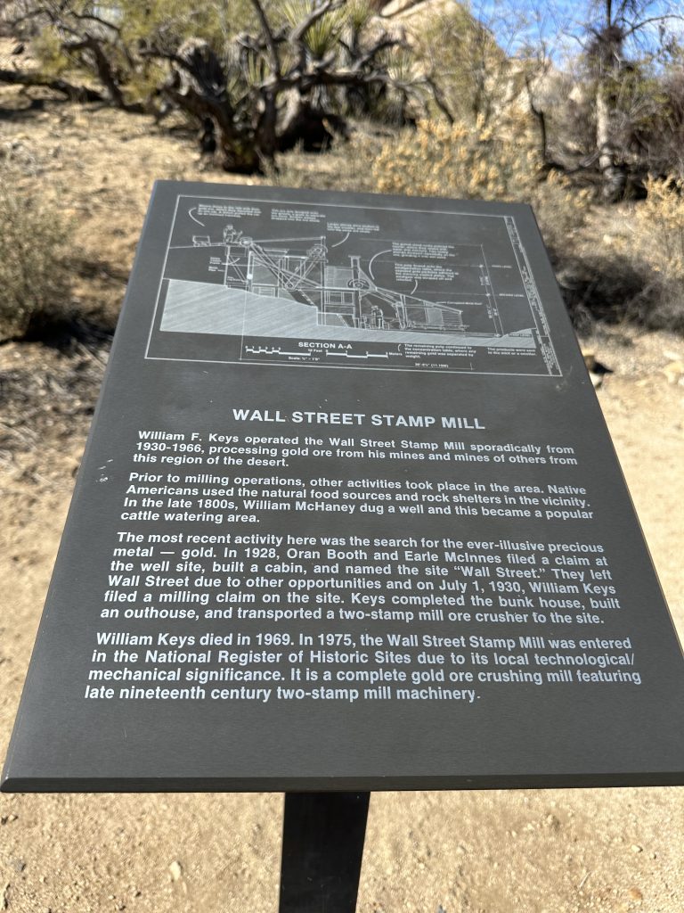
Wall Street Mill
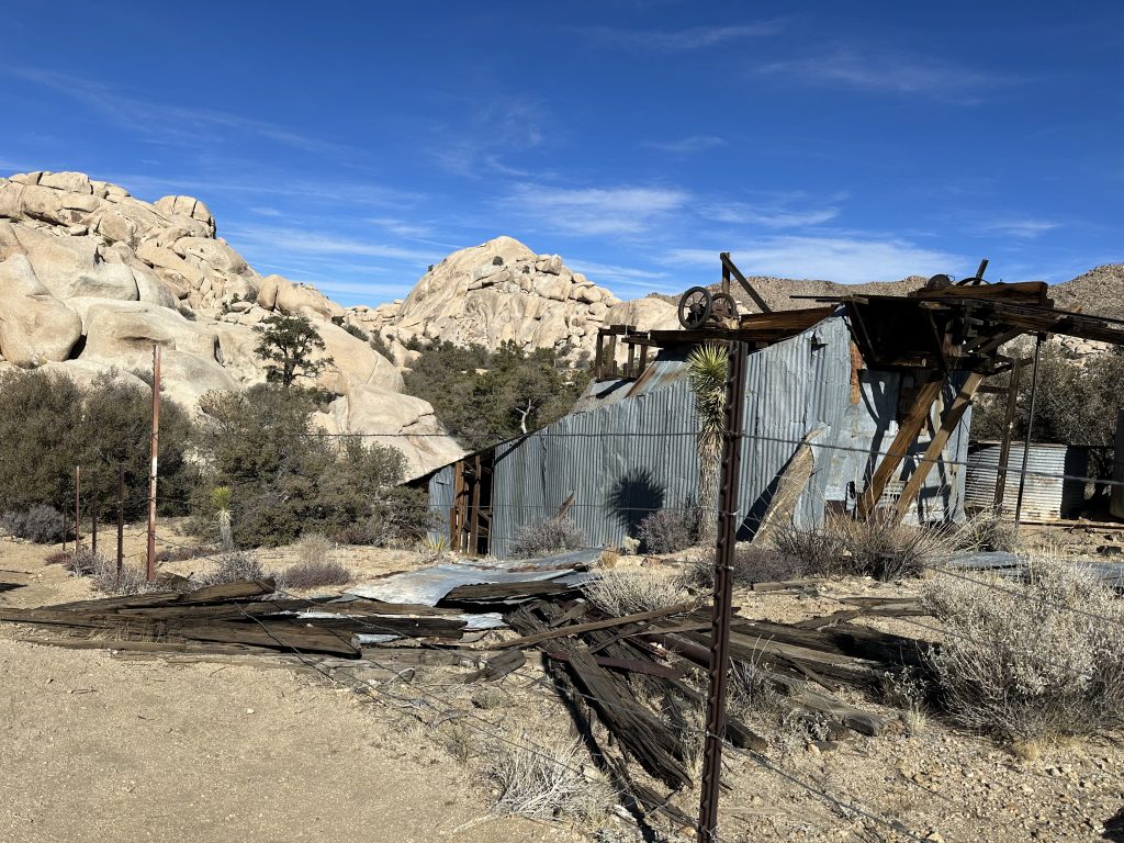
Wall Street Mill is the creation of Bill Keys. He purchased it in 1930, it had an existing well on-site, and he gathered machinery from other mill sites, in the area and created a two-stamp mill. A two-stamp mill is a type of milling equipment that drops two heavy iron “stamps” to crush rock. Gold was extracted from these crushed materials, then returned to the miners for a fee. This mill was used to process ore from many miners, providing a profitable way for independent miners to stay in business. Bill Keys ran the mill on and off as necessary.
Worth Bagley
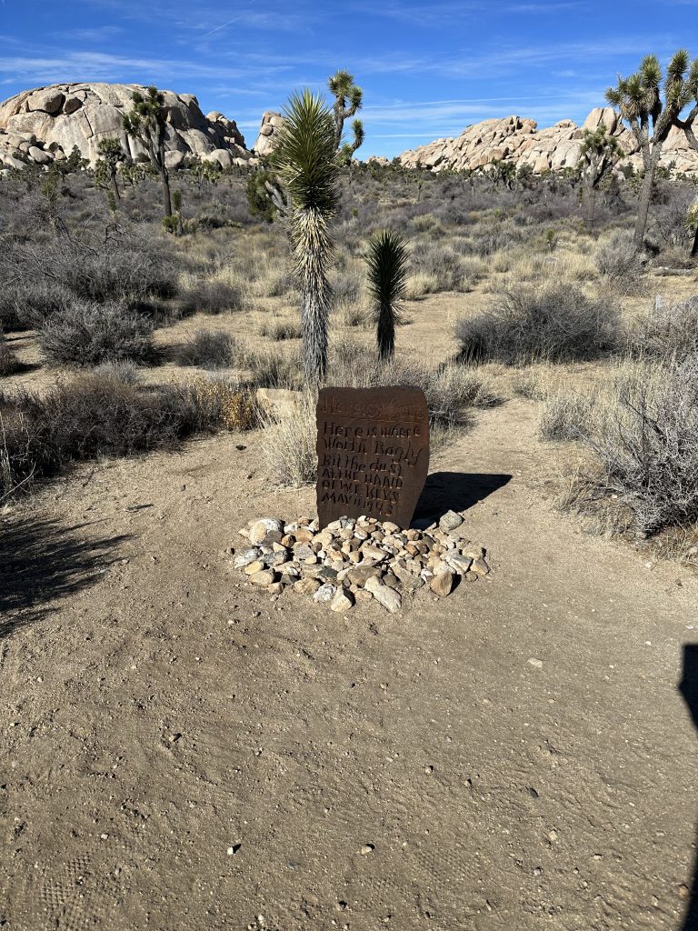
This is the location of the shootout between Worth Bagley and William Keys in 1943. The two men constantly argued over land ownership, eventually leading to a gunfight. Bagley initiated the confrontation but when it ended Bagley was dead and Keys was convicted of manslaughter. William Keys served time in San Quentin State Prison before returning to his home at Keys Ranch.
Lost Palm Oasis
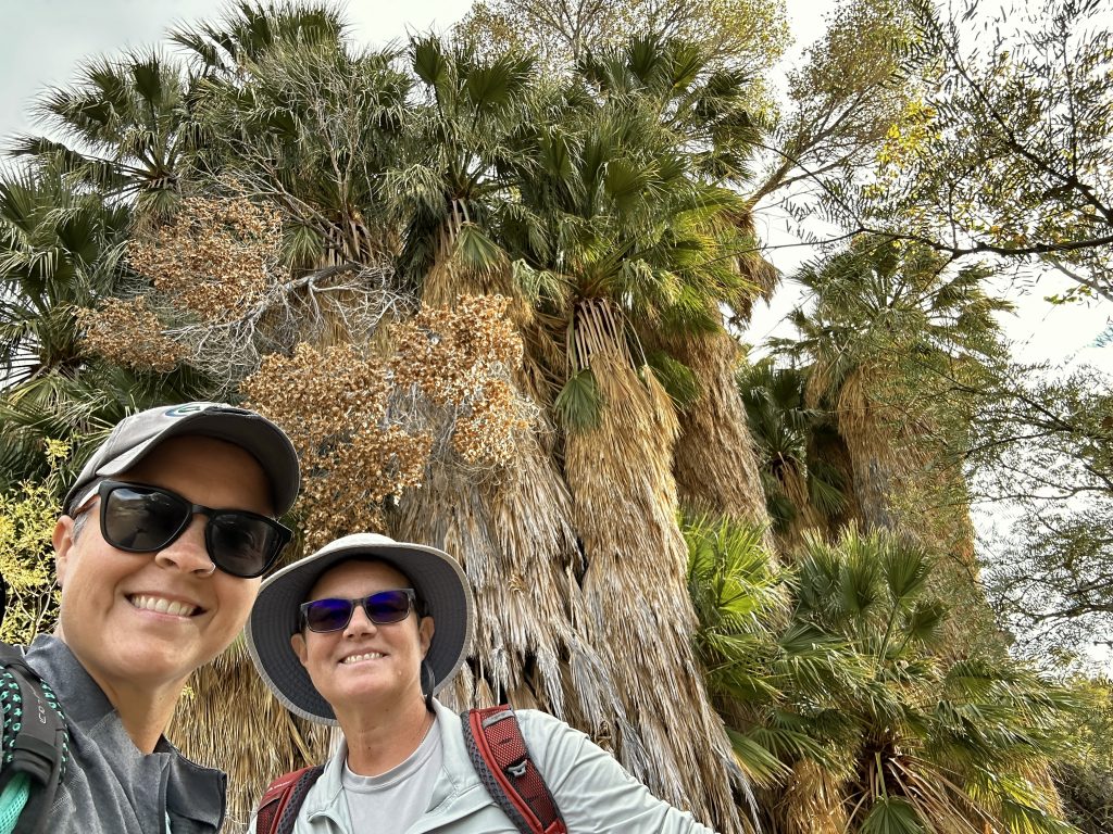
Lost Palm Oasis is near the southern entrance of the park. Light rain was in the forecast, but we decided to hike anyway. We packed our rain gear and began the 7.4 mile round trip hike through varied terrain and lush (for desert standards) vegetation. Because of the lower elevation of the area there were not any Joshua Trees, however the palms growing in the oasis were amazing.
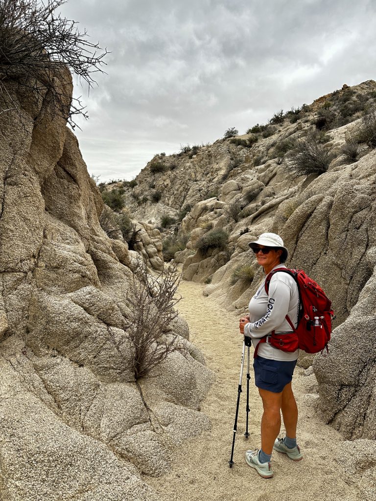
A couple of miles into the hike we walked through an incredible slot canyon. It was impressive to see from above, we crossed a large wash and then climbed out of the canyon and continued along the trail. The surface of the trail was a granular soil consisting primarily of the eroded granite. It was crunchy and reminded us of many trails we had hiked in New Hampshire.
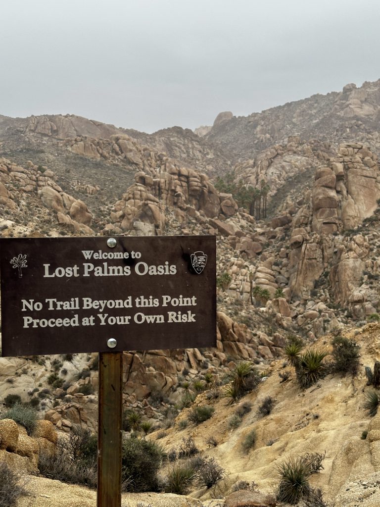
This sign indicates the end of the official hike. We briefly explored the area, because it had begun to rain. We were expecting a brief shower, but instead it was a hard cold rain. After putting on our rain coats and warm clothes, we turned on our after burners and headed back to the car.
To our amazement the desert was coming alive in front of our eyes. The cacti and flowers looked happy, they seemed to be standing taller and blossoms were open wider. The rain washed the dust off the vegetation and rock formations making everything appear brighter. We were soaked and cold, when we made it back to the car. But, because of the rain, I would rate this is as one of the best hikes we have been on. It is awesome to see the changes in such a short amount of time.
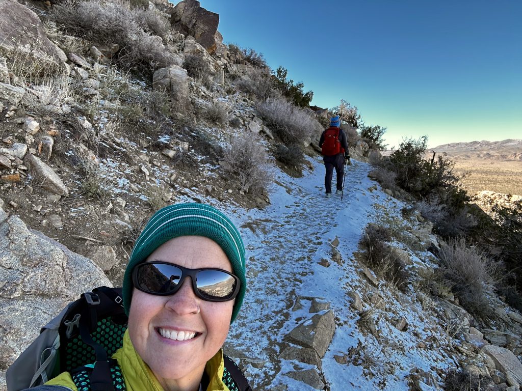
Ryan Mountain
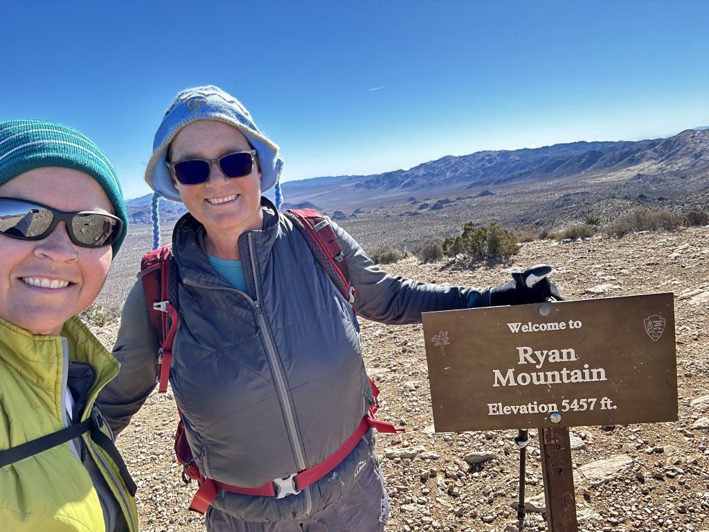
Ryan Mountain is a fun climb, I would rate it as moderate. The trail is 2.9 miles long round trip, gaining just under 1100′ of elevation. The beginning of the trail is an enormous stair stepper with great footing. The rock steps, transition to beautiful stretches of gradual switchbacks which are easy to walk on.
A couple of things I enjoyed about this trail is there are no sections of wash to navigate. In general, hiking in washes and loose soils is part of hiking in the desert. The summit also has 360 degree views, providing an amazing perspective of the park.
On this particular hike the temperature on the car display was below freezing at the start of our hike. We layered all of our clothes, including winter hats and gloves, and started out. The shaded side of the mountain, was coated in snow. What an amazing site in a desert environment. At the summit I found enough snow to lie down and make a snow angel! As the sun rose high into the sky, it melted most of the snow away before we reached our car.
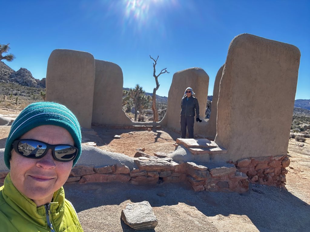
Ryan Ranch
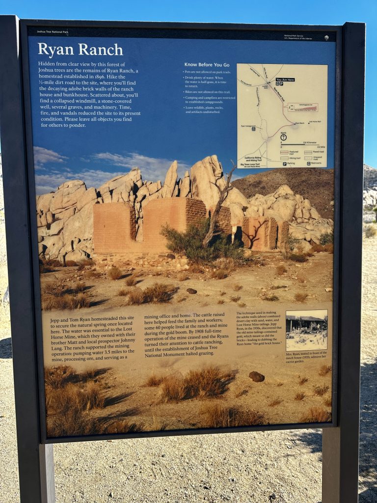
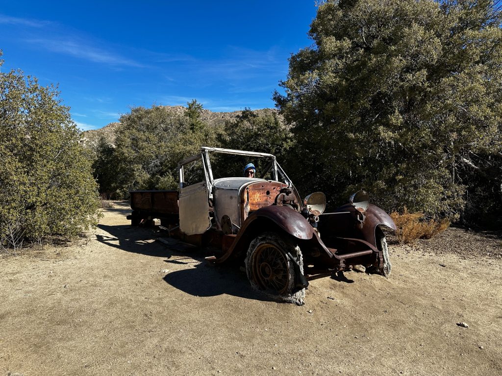
Ryan ranch is visible from the summit of Ryan mountain. In the 1890’s the ranch was homesteaded by Tom and Jep Ryan. A half mile trail provides access to explore the remnants of ranch. The brothers picked this location because of the spring located here. They needed the water for their mining operations at their Lost Horse Mine.
The ranch also provided a home for their families and workers. As many as sixty people lived here, raising cattle and providing for themselves off the land. There are building, windmill, machinery, and vehicle remnants. It took us about an hour to explore the area and capture lots of great photos.
Keys View

Keys View is a short drive on a spur road just past Ryan’s Ranch. The road ends at large parking area, a short handicap accessible walk to the top of the viewing area, provides some of the best views in the park. Because, this location primarily looks towards the southwest it is a very popular place to see sunsets. The Coachella Valley is in full view below.
In the photo above the magnificent 11500′ San Gorgonio Mountain is in the background. We also could see into the cities of Indio and Palm Springs. Amazingly, seeing the San Andres fault and Salton Sea were highlights, for us. This drive inspired us to go explore many of the places we saw closer up. That blog will be coming soon!
Split Rock, Skull Rock, Discovery Trail
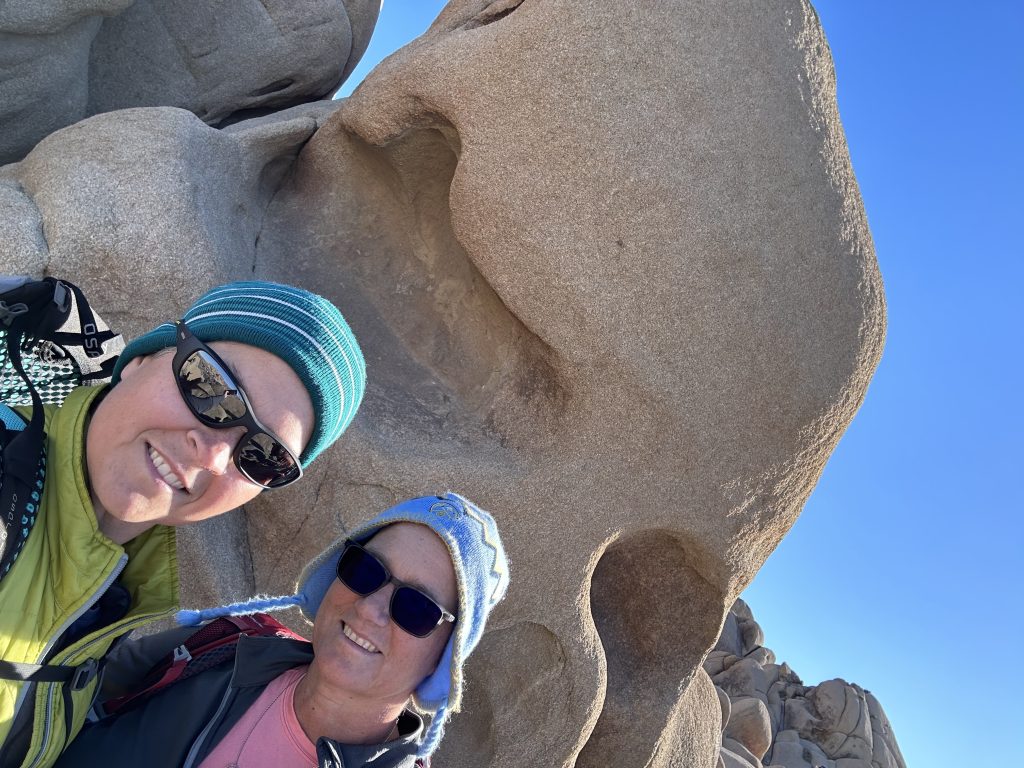
Like many of the areas in this park we grouped multiple trails together. Parking is available in several locations and a variety of loops and trails are possible. Skull rock is amazingly weathered and resembles a human skull. Our loop hike was about five miles long, and included lots of “playing”. We found many treasures. As a kid, who grew up watching Hanna-Barbera’s Flintstones, I was easily transported to Bedrock City. I recommend exploring with a child’s eyes and letting your imagination run wild!
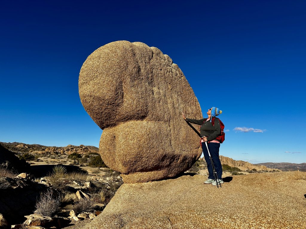
Life sized Pac-Man?
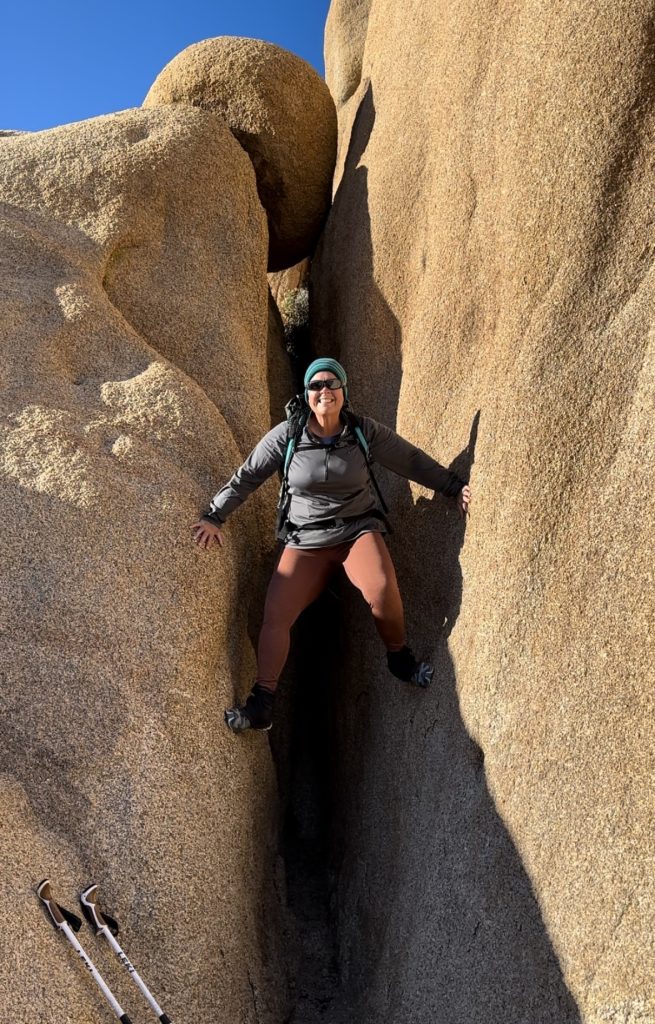
Jess having fun, climbing up this crevasse like a pro!
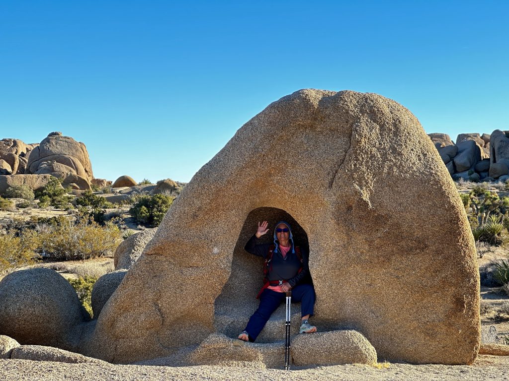
Me, just landing and emerging from my capsule!
Black Rock Canyon
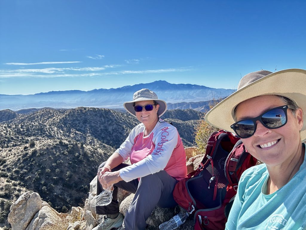
Black Rock Canyon area and trails are located in the Northwestern corner of the park. We decided to combine the Panorama Loop trail, with the Warren Peak spur trail. Our total mileage was just under eight miles and about 1700′ of elevation gain. The first part of the trail is sandy wash, we made great time, but it is definitely a challenge. I joked with Jess, that we were conditioning ourselves to play beach volleyball.
Once we reached the canyon the footing improved and we traversed switchbacks and along ridges to the high point of the Panorama loop at 5154′. From there the trail crosses along ridges, providing beautiful views along the way. After descending for a while we reached the trail to the summit of Warren Peak. It was a steep ascent to the 5103′ summit. We had the place to ourselves! For a glimpse of our hike watch this video of us on the trail.
Joshua Tree National Park is an amazing place! We hiked in oppressive heat, hard cold rains, and snow. We were aware of the weather and prepared for anything. Hiking and exploring safely is our top priority. There are still more places for us to explore in this park. Hopefully, we will be able to return again, someday.
Live Simple Live Happy